
Download image

Scanned by
Library of Congress
Notes
Cropped, edited, and prepared for use here by Don Sailer, Dickinson College, May 11, 2009.
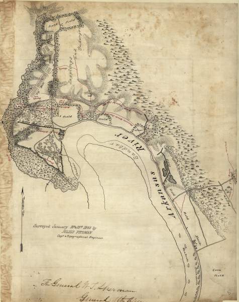
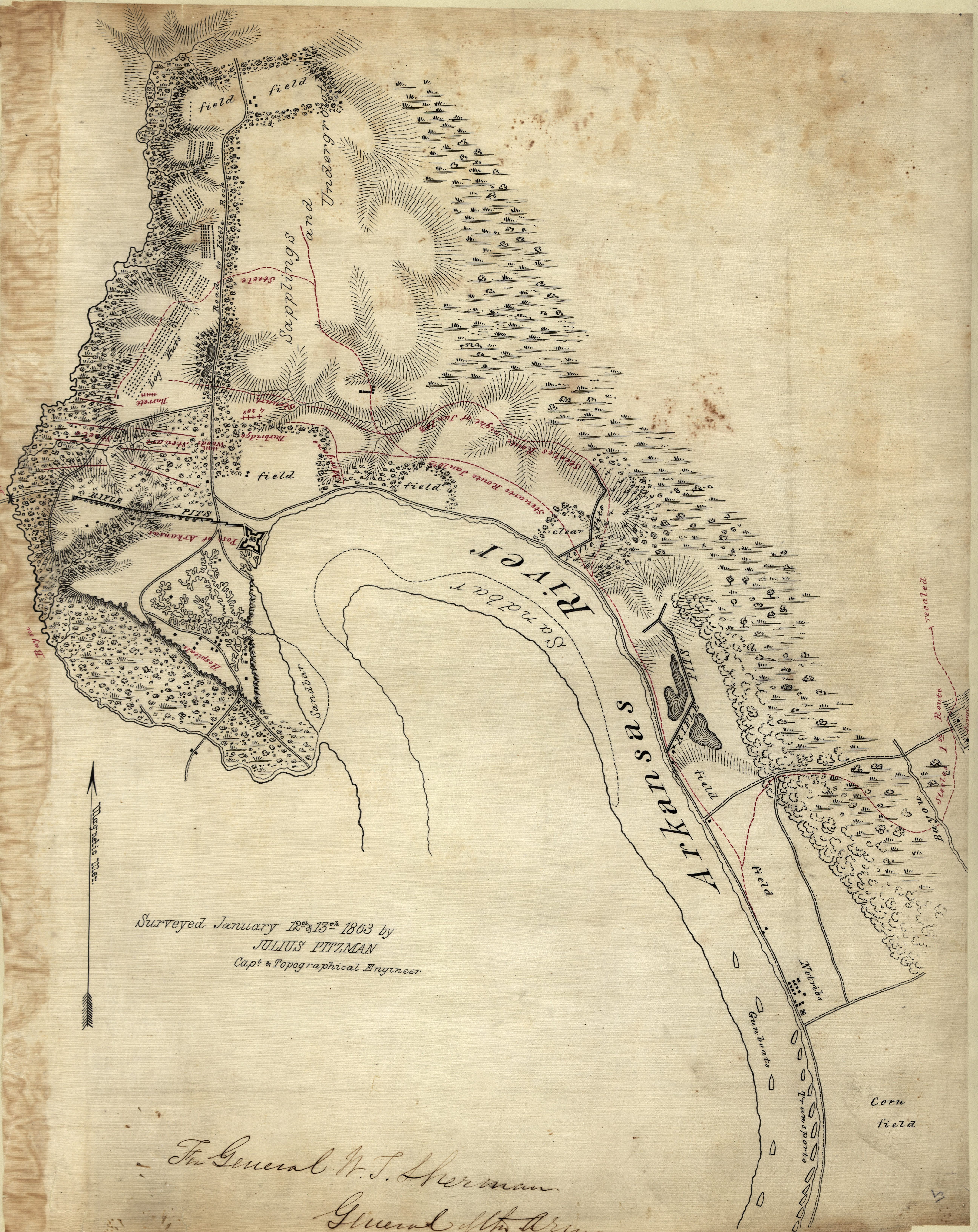
Depicted ContentBattle of Arkansas Post
Image type
map
Courtesy of
Library of Congress Geography and Map Division
Original caption
[Map of Arkansas Post, Ark.] / surveyed January 12th & 13th 1863 by Julius Pitzman, Capt. & Topographical Engineer.
Source citation
Map Collections, Library of Congress Geography and Map Division