
Download image

Scanned by
John Osborne, Dickinson College
Scan date
Notes
Cropped, sized, and prepared for use here by John Osborne, Dickinson College, August 4, 2009.
Image type
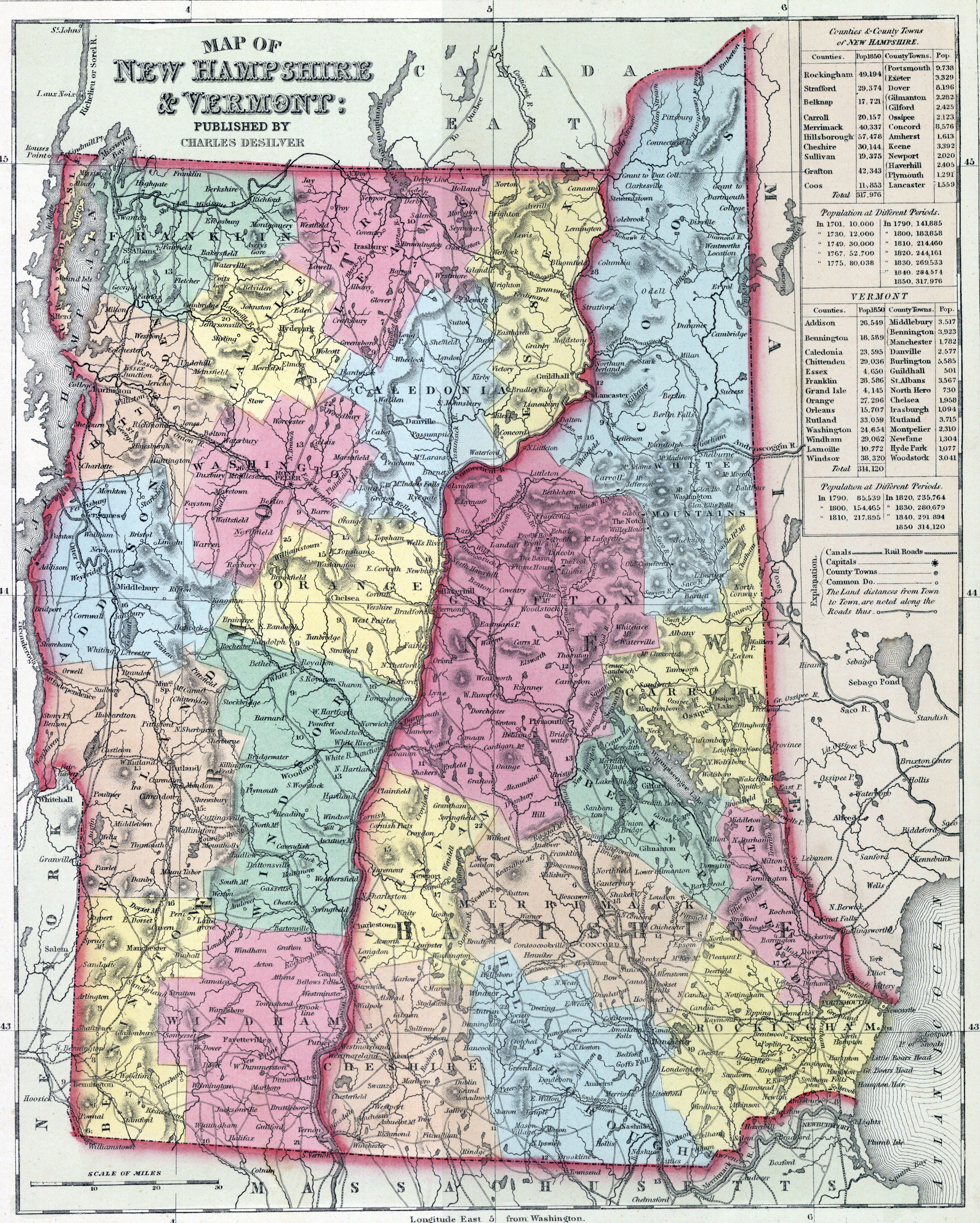
map
Source citation
Mitchell's New Universal Atlas.... (Philadelphia: Charles Desilver, 1857), 8.