
Download image

Scanned by
Library of Congress
Notes
Cropped, sized, and prepared for use here by John Osborne, Dickinson College, August 7, 2009.
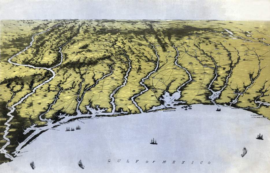
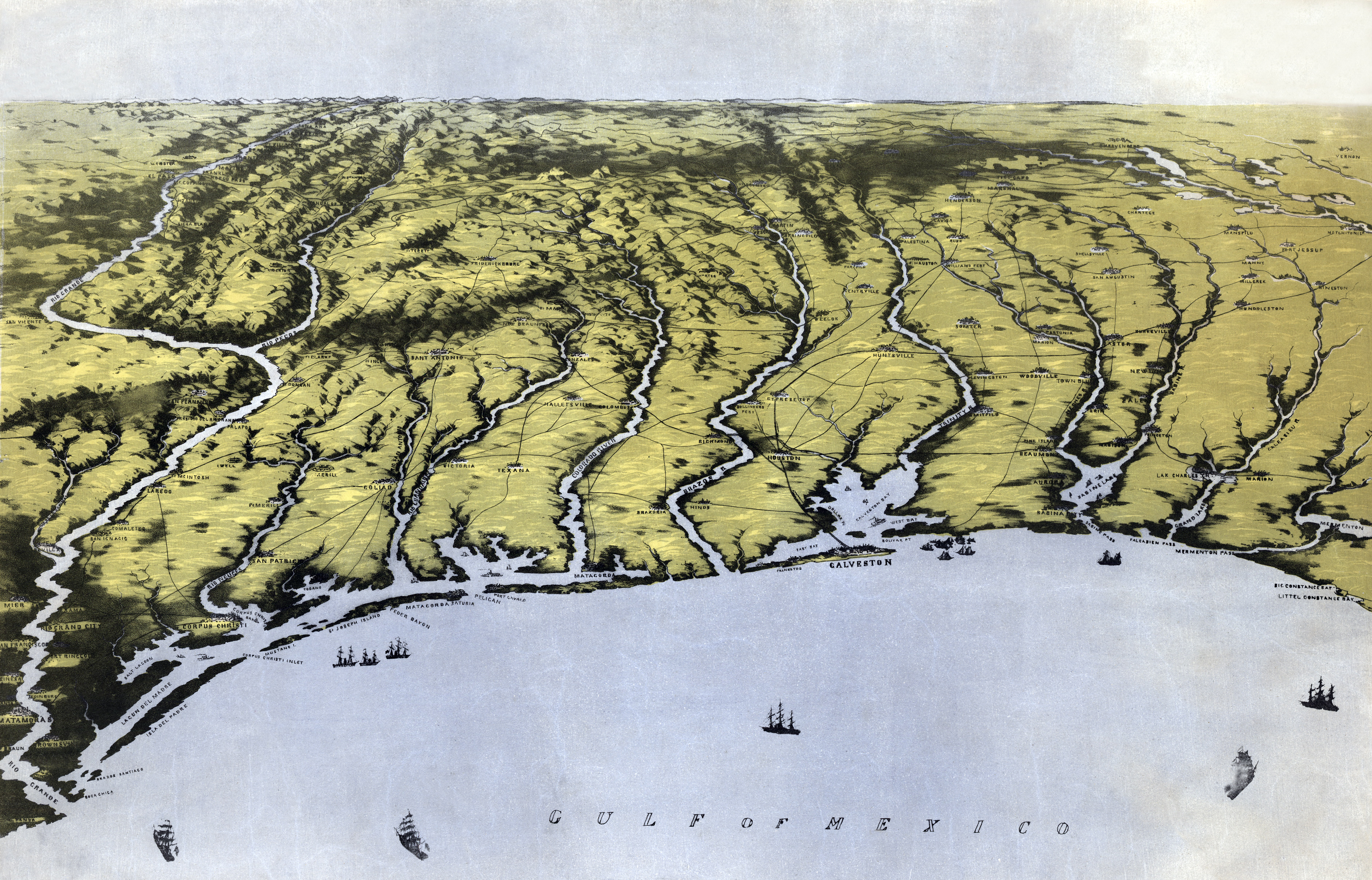
Depicted ContentTexas
Image type
map
Courtesy of
Library of Congress Geography and Maps Division
Original caption
Panorama of the seat of war: bird's eye view of Texas and part of Mexico/ drawn from nature and lith. by John Bachmann.
Source citation
Civil War Maps Collection, Library of Congress Geography and Maps Division
Source note
Artist: John Bachmann