
Download image


Scanned by
John Osborne, Dickinson College
Scan date
Notes
Some severe staining due to use and age.
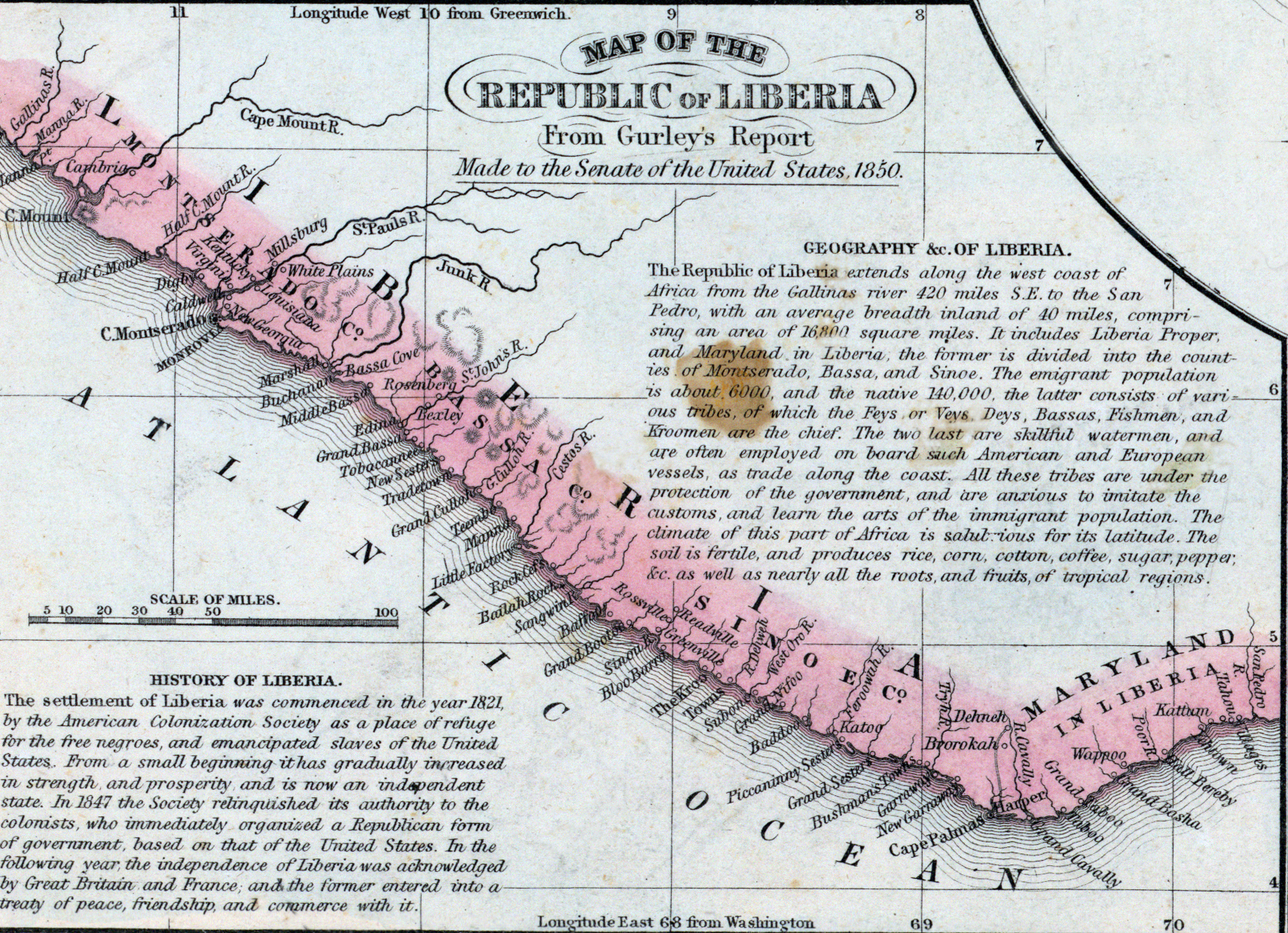
Depicted ContentLiberia
Image type
map
Original caption
Map of the Republic of Liberia from Gurley's Report made to the Senate of the United States, 1850
Source citation
Mitchell's New Universal Atlas.... (Philadelphia: Charles Desilver, 1857), 74.