
Download image

Scanned by
John Osborne, Dickinson College
Scan date
Notes
Cropped, edited, and prepared for use here by John Osborne, Dickinson College, July 3, 2010.
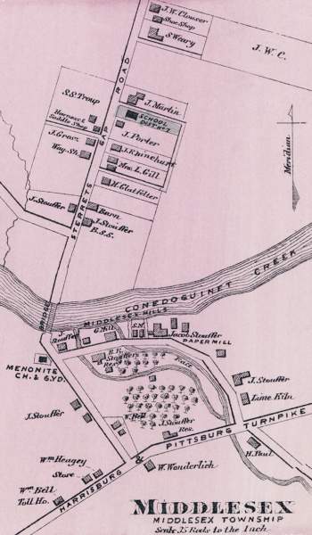
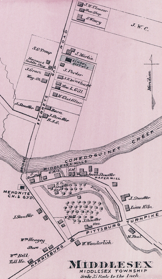
Depicted ContentMiddlesex, PA
Image type
map
Original caption
Middlesex
Source citation
Atlas of Cumberland Co. Pennsylvania. From actual surveys by and under the Direction of F.W. Beers (New York: F.W. Beers, Co., 1872), 15.
Source note
Louis E. Neuman, engraver; Charles Hart, lithographer.
Cropped from larger image, also available here.