
Download image

Scanned by
John Osborne, Dickinson College
Scan date
Notes
Sized, cropped, and prepared for use here by John Osborne, Dickinson College, January 8, 2013
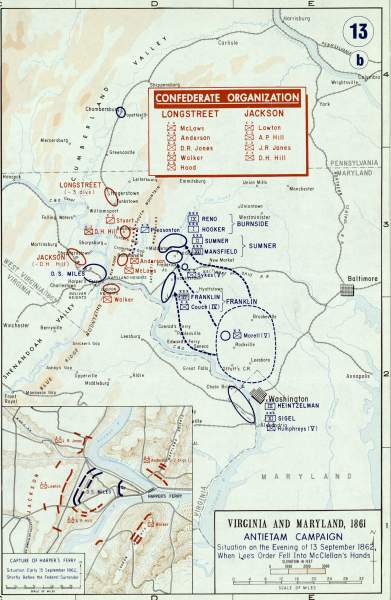
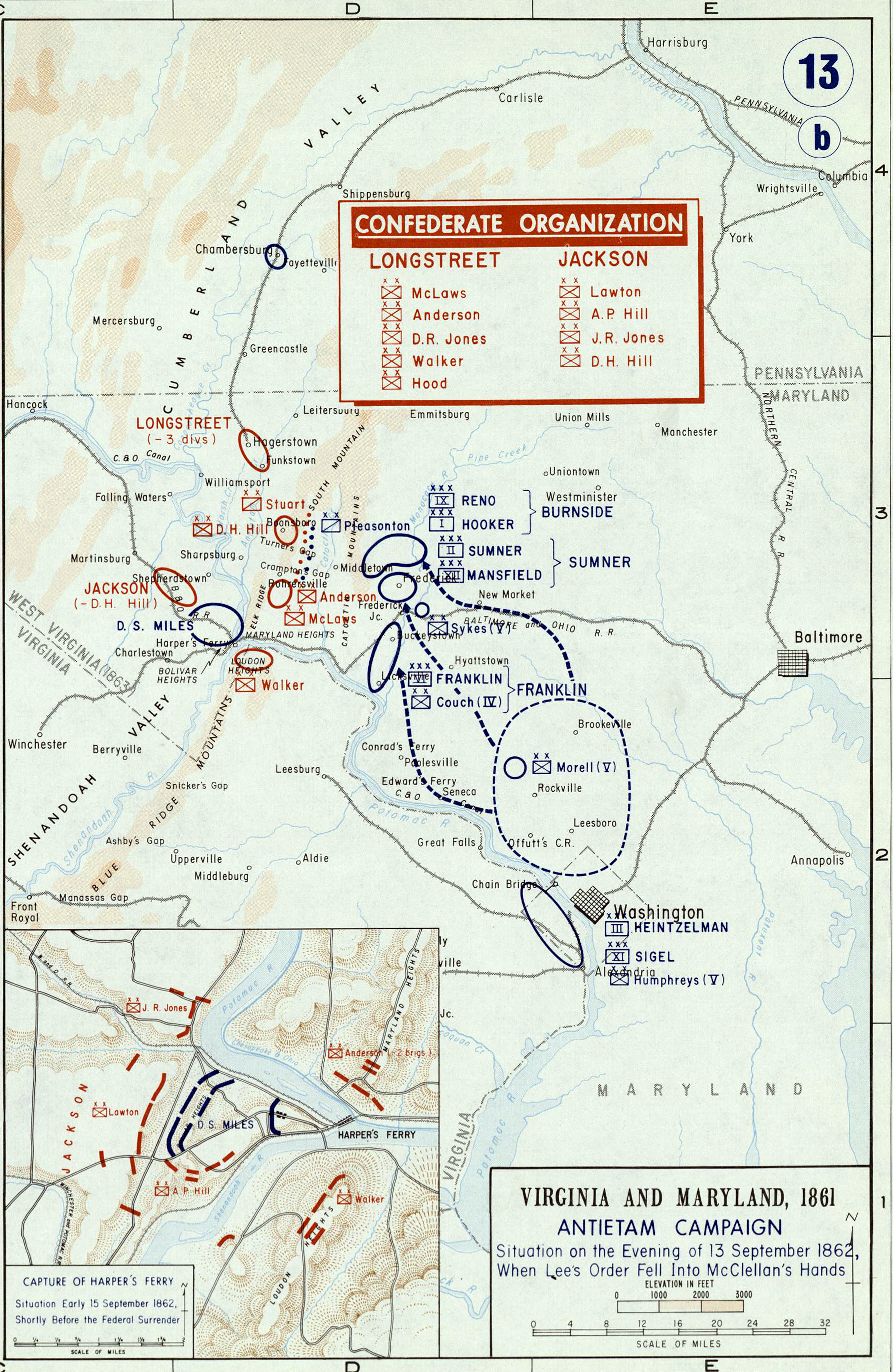
Depicted ContentBattle of Antietam
Image type
map
Courtesy of
United States Military Academy
Original caption
Virginia and Maryland ... Antietam Campaign ... Situation on the Evening of 13 September 1862, When Lee's Orders Fell Into McClellan's Hands
Source citation
Gerald P. Stadler and Arthur V. Grant, Jr., Campaign Atlas of the American Civil War(West Point, NY: United States Military Academy, 1978), 13.