

Scanned by
Brenna McKelvey, Dickinson College
Scan date
Notes
Sized, cropped, and adjusted for use here by John Osborne, Dickinson College, June 25, 2010.
Image type
map
Original caption
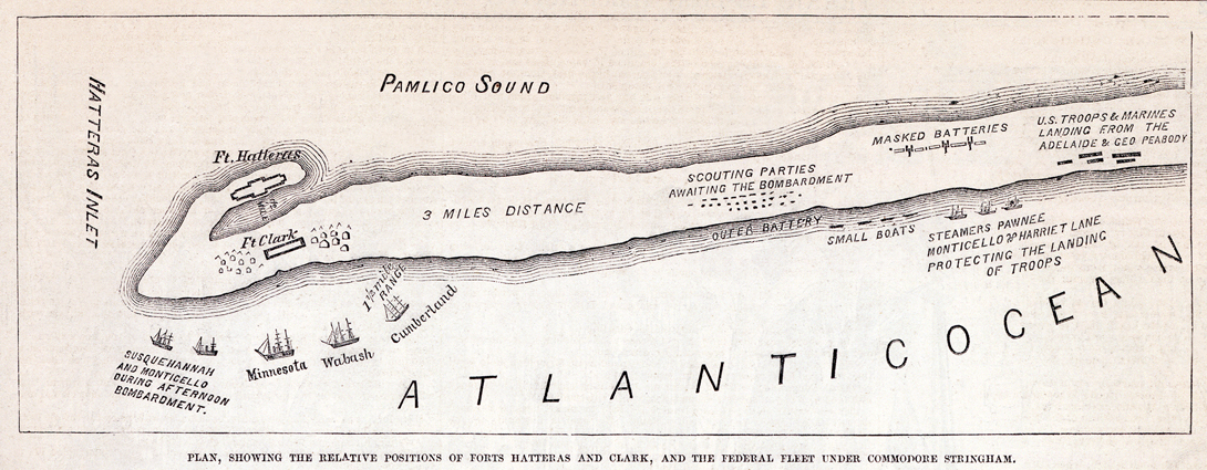
Plan, showing the relative positions of Forts Hatteras and Clark, and the Federal fleet under Commodore Stringham
Source citation
Frank Leslie's Illustrated Newspaper, September 7, 1861, p. 271.