

Scanned by
John Osborne, Dickinson College
Scan date
Notes
Sized, cropped, and prepared for use here by John Osborne, Dickinson College, January 25, 2013
Image type
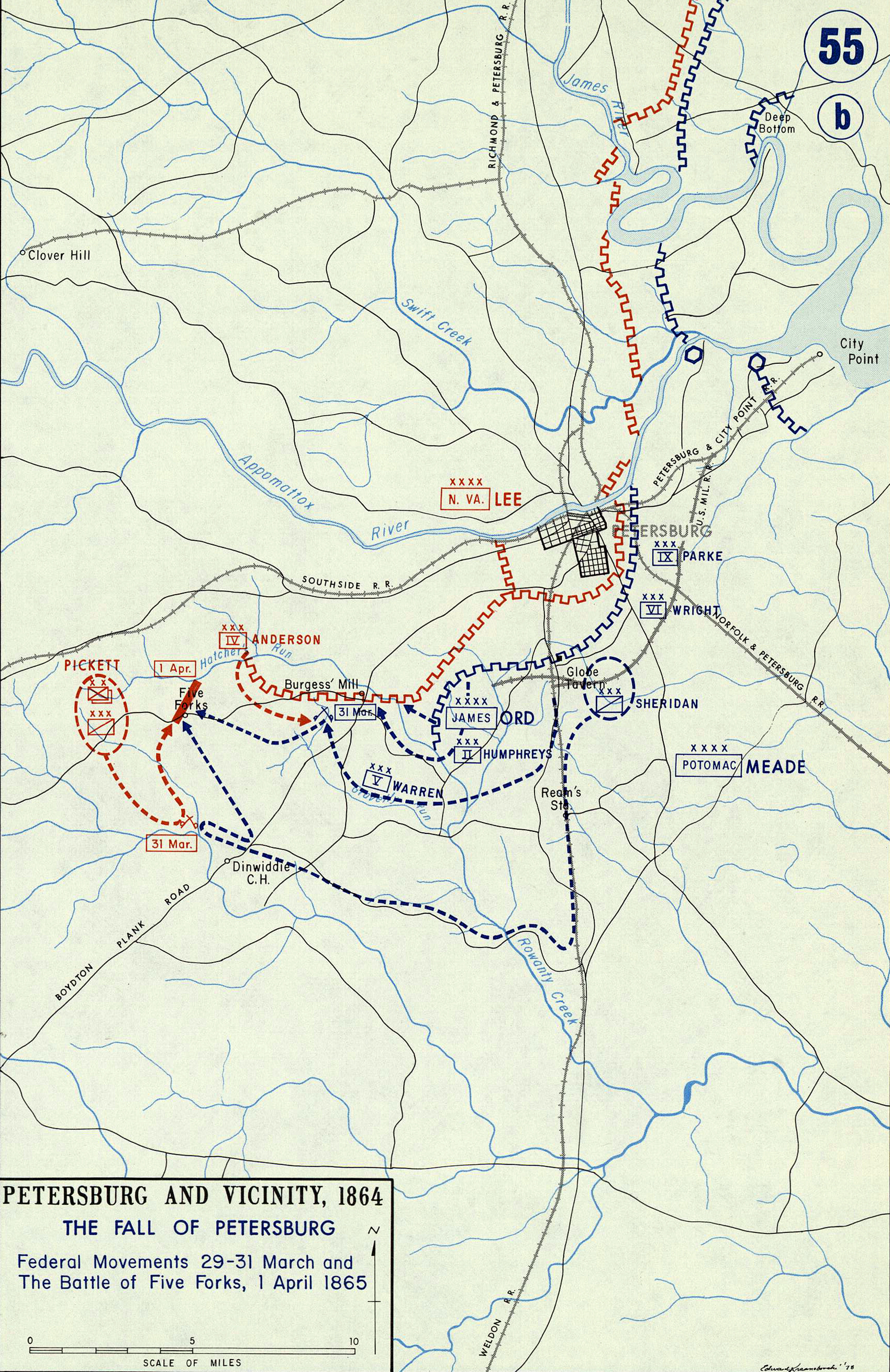
map
Courtesy of
United States Military Academy
Original caption
Petersburg and Vicinity 1864 .. The Siege of Petersburg .. Federal Movements 29-31 March and the Battle of Five Forks, April 1, 1865
Source citation
Gerald P. Stadler and Arthur V. Grant, Jr., Campaign Atlas of the American Civil War(West Point, NY: United States Military Academy, 1978), 55.