

Scanned by
Joseph Williams, Archives and Special Collections, Dickinson College
Scan date
Notes
Cropped, sized, and prepared for use by John Osborne, Dickinson College, May 5, 2014.
Image type
map
Original caption
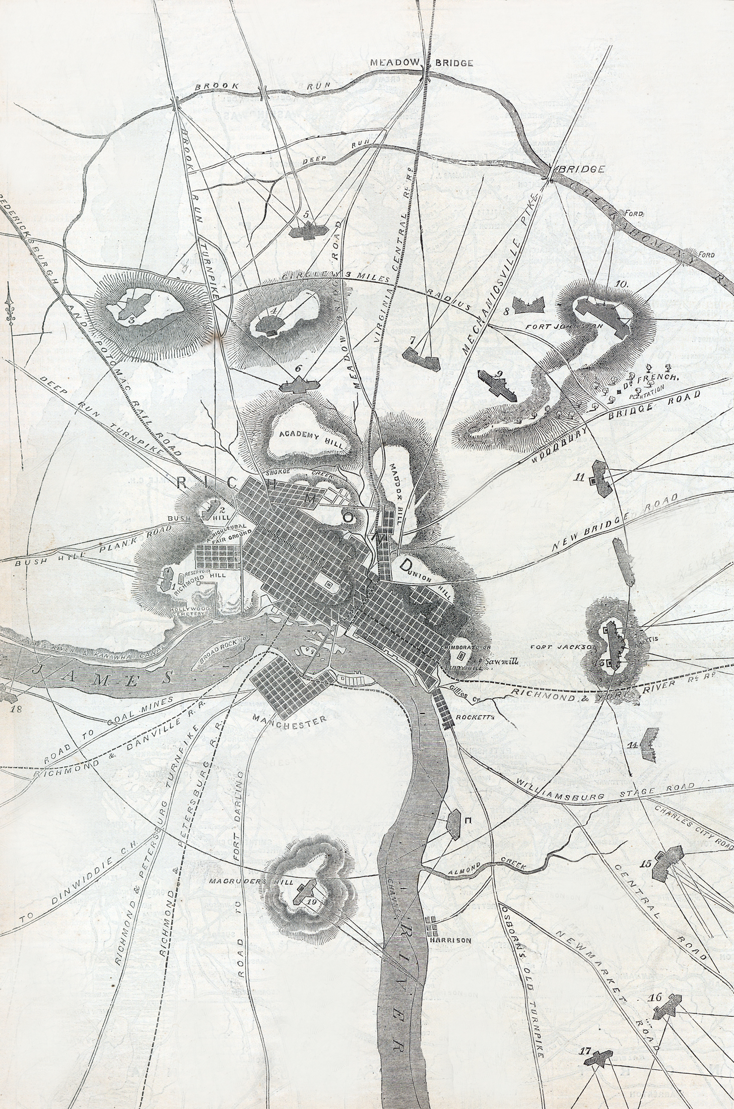
Map of Richmond, Virginia, showing its defenses and railroad connections - drawn by Charles Sholl. topographical engineer
Source citation
Harper's Weekly Magazine, May 28, 1864, p. 332.