

Scanned by
Jia Ma, House Divided Project, Dickinson College
Scan date
Notes
Cropped, sized, and prepared for use here by John Osborne, Dickinson College, November 15, 2016.
Image type
map
Courtesy of
Archives and Special Collections, Dickinson College
Original caption
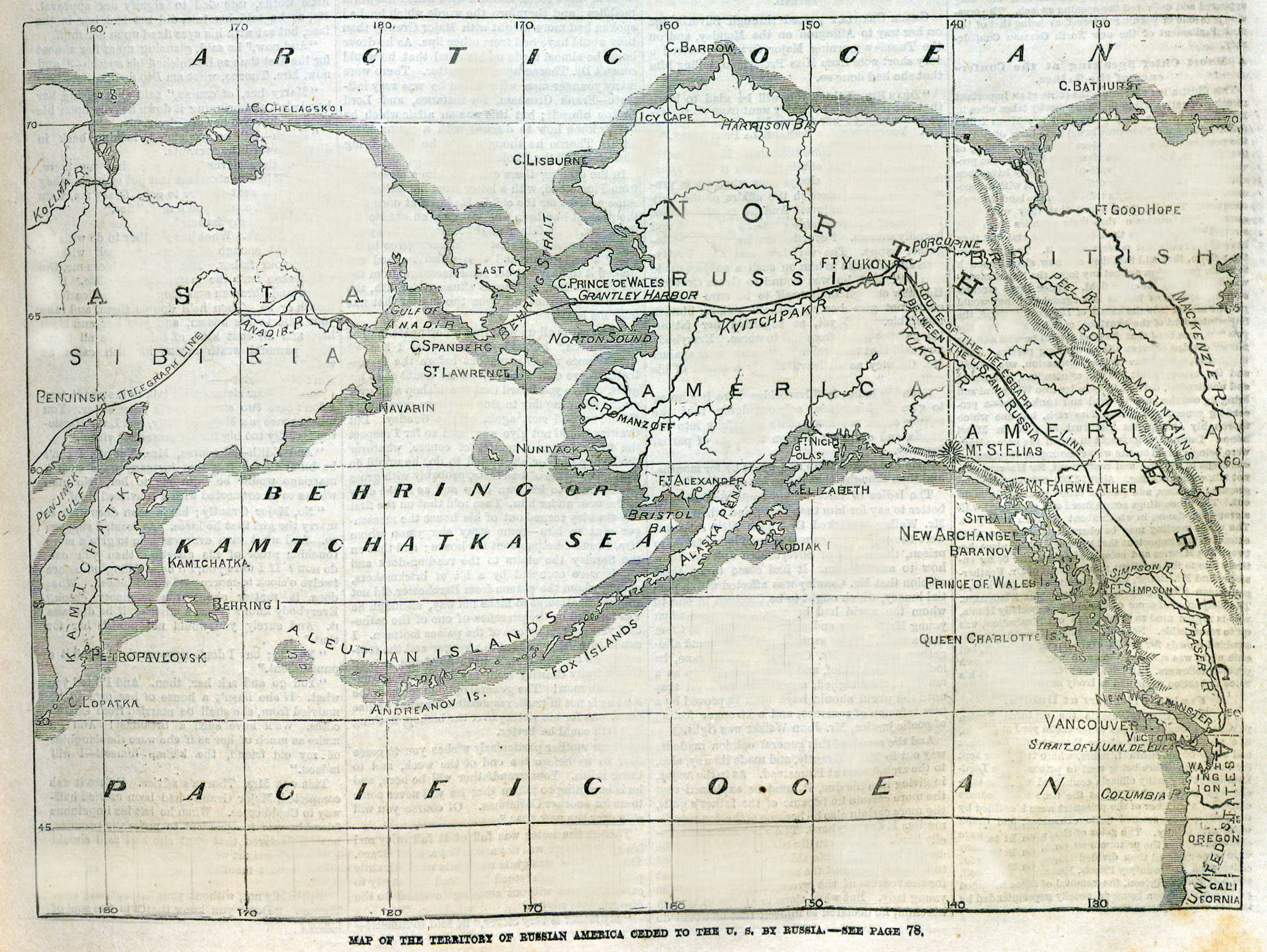
Map of the territory of Russian America ceded to the U.S. by Russia.
Source citation
Frank Leslie's Illustrated Newspaper, April 6, 1867, p. 37.