Columbia, South Carolina (Hayward)
Gazetteer/Almanac
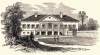
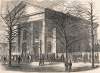
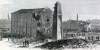
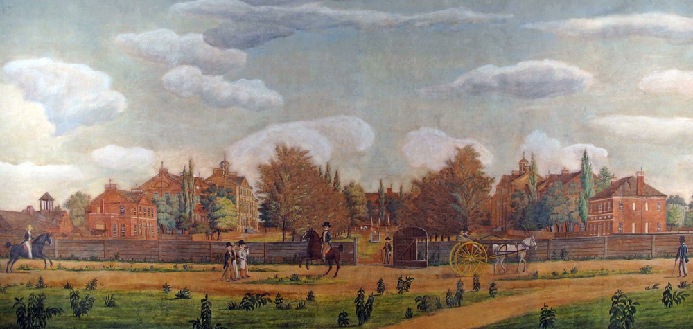
Columbia, S. C. City, capital of the state, and seat of justice of Richland co. 73 miles N. E. from Augusta, and 120 miles N. N. W. from Charleston. Situated on the E. side of the Congaree River, immediately below the confluence of the Broad and Saluda Rivers, which unite to form the Congaree. The city stands upon an elevated plain, about a mile back from the river, from which there is a handsome and extensive prospect in all directions. It is laid out with regularity, the streets crossing each other at right angles, 100 or 150 feet in width, and many of them ornamented with trees. The state house, near the centre of the city, is a plain edifice of wood, 170 feet long, 60 feet wide, and two stories high. The other public buildings are a court house and jail, a town hall, a market house, an academy, and a female seminary, a large lunatic hospital, and churches of the Presbyterian, Episcopal, Methodist, Baptist, and Roman Catholic denominations. The edifice of the Presbyterian Church is an elegant building, with two lofty spires. The buildings of the South Carolina College, which is situated here, are handsomely located upon a lot of 25 acres, enclosed by a wall of brick. The buildings, which are of brick, consist of two for students, 200 feet long, 25 feet wide, and three stories high, a building for the library and other rooms for the use of the college, upon the top of which is an astronomical observatory. The president's house is situated at the head of the opening between the two college buildings, which are placed opposite to each other. There is also a theological seminary at Columbia, founded in 1831. Columbia is a place of considerable business. A railroad extends to Branchville, 60 miles, where it connects with the Charleston and Augusta Railroad. A steamboat also plies between Columbia and Charleston. The Saluda Canal, about six miles long, built for the purpose of avoiding the falls in the Congaree, passes through the city, and boats of large draught ascend to this place.
John Hayward, Gazetteer of the United States of America… (Philadelphia: James L. Gihon, 1854), 335.