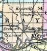
RAY COUNTY, situated in the westerly part of Missouri, with Missouri river on the south. Area, 570 square miles. Seat of justice, Richmond. Pop. in 1830, 2,657; in 1840, 6,553; in 1850, 10,373. (Fanning's, 1853)
RAY, a county in the W. N. W. part of Missouri, contains about 560 square miles. The Missouri river forms the entire southern boundary, and it is traversed by Fishing and Crooked creeks. The surface is undulating, and consists partly of prairies and partly of forests. The soil is fertile both on the river bottoms and on the uplands. Indian corn, wheat, oats, butter, tobacco, and hemp are the staples. Many cattle, horses, and swine, are reared. In 1850 it produced 655,020 bushels of corn ; 48,003 of wheat ; 138,641 of oats; 183,137 pounds of butter; 616,906 of tobacco, and 431 tons of hemp. It contained 8 churches, 500 pupils attending public schools, and 123 attending other schools. Limestone and bituminous coal are abundant. Named in honor of ------ Ray, a member of the convention to form the state constitution. Capital, Richmond. Population, 10,373, of -whom 8859 were free, and 1514 slaves. (Baldwin & Thomas, A New and Complete Gazetteer of the United States ... 1854)