Missouri (Hayward)
Gazetteer/Almanac
MISSOURI is one of the Western — or, at present, more properly, one of the Central — states of the American Union. It formerly composed a part of the extensive tract, which, under the name of Louisiana, was purchased of France by the United States in the year 1803. In the following year, that portion of the country which now forms the State of Louisiana was set off from the residue, and denominated the Territory of Orleans; the remainder being styled the District of Louisiana,, until 1812, when the name was changed to the Territory of Missouri. Another division took place about eight years afterwards, and in 1821 the state was formed out of a section of that territory, and duly admitted into the Union. Some of the places within the present limits of Missouri were settled as early as the year 1764, by hunters and traders generally from the north and east. In that year the city of St. Louis was founded, now the largest commercial place on the Mississippi, excepting New Orleans. St. Charles, on the Missouri, was established in 1780, and New Madrid on the Mississippi, in 1787.
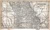
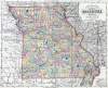
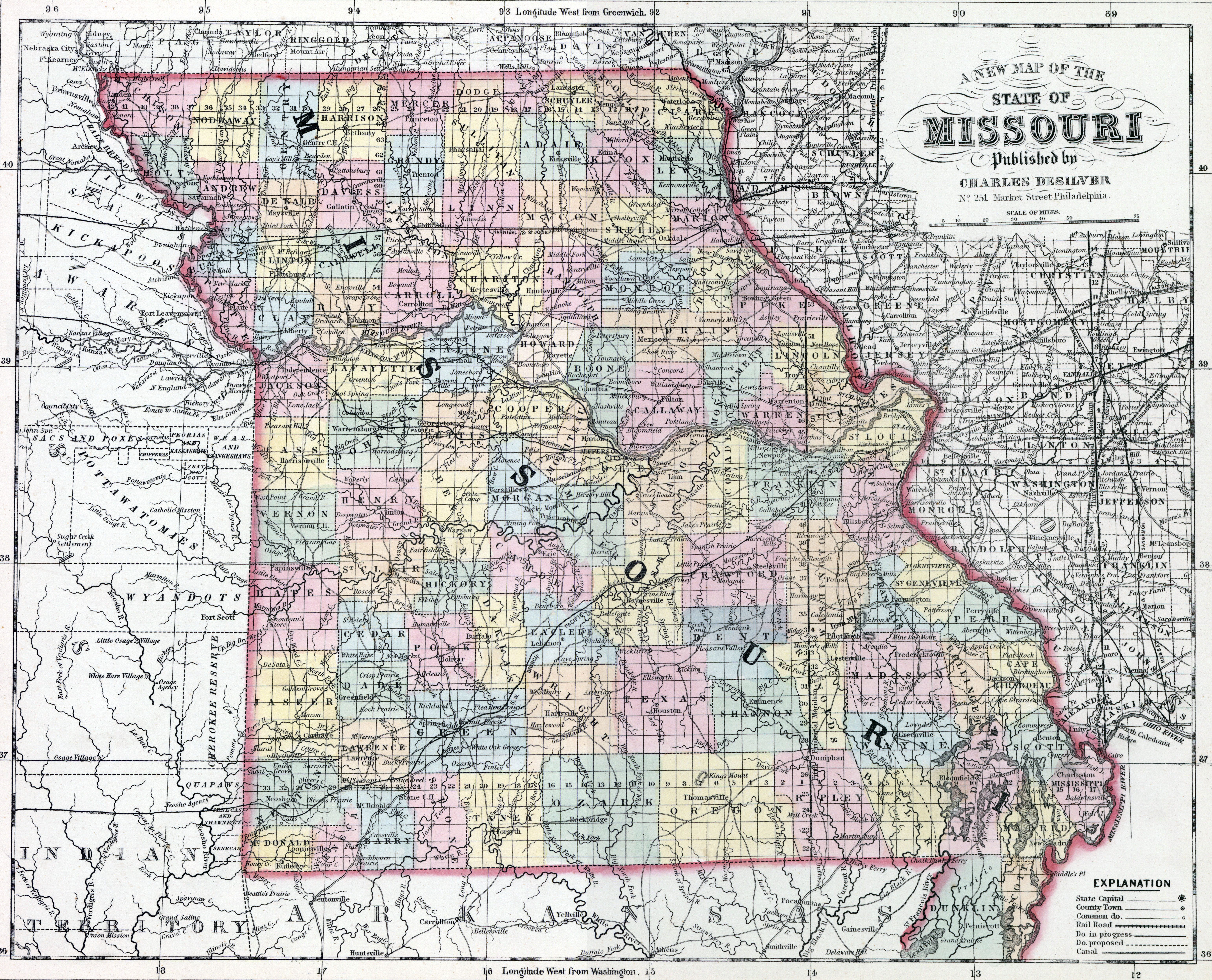
Boundaries and Extent. — Missouri is bounded north by the State of Iowa; east by the Mississippi River, which separates it from the States of Illinois, Kentucky, and part of Tennessee; south by the State of Arkansas; and west by the Indian Territory, and by the River Missouri, dividing it from the Deserts of Nebraska. It extends from 36° to 40° 36' north latitude, and lies between 89° and 95° 45' west longitude. Its area is estimated at 67,380 square miles, being about 278 miles in length by 235 in breadth.
Government. — The governor and lieutenant governor are chosen, by a plurality of the popular votes, for four years, and are not eligible for two terms in succession. The lieutenant governor is ex officio president of the Senate. The legislature consists of a Senate, in number not less than 14 nor more than 33; and a House of Representatives, not to exceed 100 in number. The former are chosen for four years — one half every second year; and the latter every second year, in counties, to serve two years. The legislature meets biennially, on the last Monday in December, and the members receive three dollars per diem for sixty days of the session, after which their pay is reduced to one dollar — a feature that might be profitably adopted in other states.
Judiciary. — The Supreme Court, having appellate jurisdiction only, is composed of three judges, who hold office for twelve years. It holds two sessions annually. There are fourteen judicial circuits, with a like number of judges, who hold office for eight years. Circuit Courts are held twice a year in each county. These have exclusive jurisdiction in criminal matters, with power to correct the proceedings of County Courts and justices of the peace, subject to appeal to the Supreme Court. The supreme and circuit judges are appointed by the governor and Senate. County Courts are established for each county, and are composed of three justices
elected by the people for four years. Their jurisdiction is limited to matters of probate and to county affairs. There are, also, at St. Louis and some other cities, local tribunals,with the ordinary powers of Municipal or Police Courts.
Education. — Several colleges flourish in different quarters of the state, most of them under the special auspices of some religious denomination. A good number of academies and other literary institutions have also been established. The common and primary schools are tolerably numerous; but in 1850 there were over 20,000 white persons above the age of 20 years who could neither read nor write.
Finances. — The amount of the state debt is about $685,000 ; the interest whereon is some $73,000 annually. In 1843, the public debt was less than one half the above sum.
Surface, Soil, &tc. — The surface and soil are much varied throughout the state. In some quarters, the lands are undulating and hilly, not rising, however, to a height that can be described as mountainous. Other portions are swampy, and subject to inundations, though heavily timbered, and having an alluvial soil of great fertility. The soil upon the uplands is in general very productive, consisting both of prairies and extensive tracts of woodland; but these are interspersed with rocky ridges and elevated barrens. The low lands, bordering on the rivers, are extremely rich. Indian corn and other grains, hemp, flax, tobacco, and sweet potatoes, are among the products of the field. Cotton is raised in the southern section of the state. Among the forest-trees are various species of oak, walnut, locust, ash, cedar, &c. Yellow and white pine abound in some localities. Grapes are found in profusion among the underwood of the forests; and most of the fruits common to the latitude of the state may be successfully cultivated.
Rivers. — This state is watered by numerous large streams, besides the great Rivers Mississippi and Missouri, the former of which flows along the eastern margin of the state, a distance, including indentations, of 550 miles; while the latter strikes its south-west angle, passes southward along its western boundary, and, crossing its centre, after having traversed the territory 384 miles, enters the Mississippi near St. Louis. The Osage, af fording boat navigation for 660 miles, the Grand, Salt, Gasconade, Chariton, Maramec, and St. Francis, are rivers of considerable magnitude.
Internal Improvements.—The people of Missouri are favored with extraordinary facilities for internal intercourse, especially by water communication. These advantages are prosecuted to an incredible extent between St. Louis and all the great commercial marts of the south and west, and intermediate places, by means of steamboats and other craft, which navigate the principal rivers for hundreds and even thousands of miles. Such facilities naturally suggest numerous projects of improvement; and a system of railroads and canals, in all probability, will ere long be superadded. At the session of the legislature in 1851, bills were passed, appropriating $2,000,000 for expediting the construction of the Pacific Railroad, and $1,500,000 towards completing the Hannibal and St. Joseph Railroad. This measure caused an immediate flow of emigration into the counties contiguous to the proposed routes. The city of Hannibal, in particular, one of the termini, received greater additions to its population within the spring of 1851 than it had acquired during the whole of the three preceding years.
Minerals. — Missouri is remarkably rich in mineral treasures, especially in the value of its lead mines. These are known to occupy an area of over 3000 square miles. They are situated within an average distance of 70 miles from the city of St. Louis. The ore is of that description denominated "galena," and is found, not in veins, but in separate masses. It yields from 80 to 85 per cent. 5,000,000 or 6,000,000 pounds are produced annually. Iron ore, of excellent quality, also abounds. In Washington county, there is a hill some 400 feet in height, three miles in length, and one mile wide at its base, known as the "iron mountain," which appears to be entirely composed of iron ore, yielding some 80 per cent, of the pure metal. There is also another eminence, about 300 feet high, one and a half mile wide at the base, consisting wholly of the species of iron ore called "pilot knob," and which is equally valuable. Copper, zinc, calamine, antimony, cobalt, nitre, plumbago, salt, &c., are among the mineral products of the same county and the contiguous region. Bituminous coal is abundant in various localities near the Mississippi.
Manufactures. — Iron, lead, and lumber are among the chief articles manufactured. There are also large numbers of grist mills, distilleries, potteries, brick, stone and marble yards, salt works, breweries, carriage and machine factories, and other establishments for the production of commodities requisite for home use, the whole employing a capital of several millions of dollars.
Indians. — There are no organized or distinct bands of Indians permanently settled within the state, most of the indigenous tribes having withdrawn to their allotted country beyond the western boundary of the state.
Population. — In 1810, the population was less than 20,000. During the following ten years, it had increased to upwards of 66,000. In 1830, it numbered 140,000; and in 1840, 383,000, including 58,000 slaves. Population in 1850, 684,132.
Climate. — The central and inland position of the state assures to its inhabitants extraordinary freedom from the sudden and trying changes which are felt by residents nearer the sea-coast in the same latitudes. The difference of temperature between the cold of winter and the heat of summer is great — the extreme range of the thermometer being from 8° below zero to 100° above. But the seasons, in their progress, are gradual and uniform, subject to few or no abrupt and violent transitions. The air is pure and salubrious, and the climate may be classed among those most favorable to health.
Religion. — The Methodists are the most numerous of the vanous religious denominations within the state. Next in numbers are the Baptists; then the Presbyterians, Roman Catholics, and Episcopalians. There are, besides, several congregations of "Cumberland" and "Associate Reform" Presbyterians, and a few Unitarian societies.
John Hayward, Gazetteer of the United States of America… (Philadelphia: James L. Gihon, 1854), 89-91.