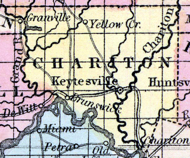
CHARITON COUNTY, situated toward the northerly part of Missouri, with Missouri river on the southwest, and Grand river on the west. Area, 832 square miles. Seat of justice, Keytesville. Pop. in 1840, 4,746; in 1850, 7,514. (Fanning's, 1853)
CHARITON, a county in the N. central part of Missouri, has an area of 740 square miles. It is bounded on the S. W. by the Missouri river, on the West by Grand river, and intersected by the Chariton river, from which it derives its name. The county is also drained by Yellow and Wolf creeks. The surface is generally undulating, and diversified by forests and beautiful prairies, the soil of which is fertile and well adapted to pasturage. Tobacco, Indian corn, wheat, oats, cattle, and pork are the staples. In 1850 this county produced 2,667,908 pounds of tobacco ; 377,397 bushels of corn ; 14,592 of wheat, and 34,170 of oats. It contained 12 churches and 1 newspaper establishment. There were 1000 pupils attending public schools, 500 attending academies or other schools. Stone coal and limestone are abundant in the county. The streams furnish motive-power for a number of mills. Capital, Keytesville. Population, 7514, of whom 5736 were free, and 1778, slaves. (Baldwin & Thomas, A New and Complete Gazetteer of the United States ... 1854)