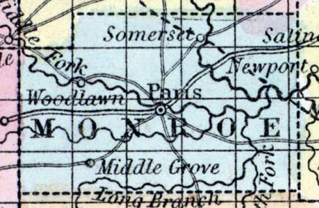
MONROE COUNTY, situated on the northeasterly part of Missouri. Area, 744 square miles. Seat of justice, Paris. Pop. in 1840, 9,505; in 1850, 10,541. (Fanning's, 1853)
MONROE, a county in the N. E. part of Missouri, has an area of about 300 square miles. It is intersected by Salt river, and also drained by the Middle fork, South fork. Elk fork, and Long branch, affluents of the first-named river, and by Crooked, Otter, and Indian creeks. The surface is undulating, and consists partly of prairies ; the soil is very productive. Indian corn, wheat, oats, tobacco, hemp, and pork are the staples. In 1850 the county produced 793,145 bushels of corn; 43,669 of wheat; 130,412 of oats, and 629,412 pounds of tobacco. It contained 25 churches, 1 newspaper office, and 1954 pupils attending public schools. Stone coal abounds in several places ; the rocks which underlie the county are limestone and freestone. Many of the streams furnish motive- power for mills. Organized in 1830. Capital, Paris. Population, 10,541, of whom 8493 were free, and 2048, slaves. (Baldwin & Thomas, A New and Complete Gazetteer of the United States ... 1854)
Record Data
Note Cards
People
Places
| Name | Type |
|---|---|
| Florida, MO | City or Town |
| Paris, MO | City or Town |
| Somerset, MO | City or Town |


