Montgomery County, MO

Headnote

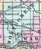
MONTGOMERY COUNTY, situated in the easterly part of Missouri, with Missouri river on the south. Area, 576 square miles. Seat of justice, Danville. Pop. in 1820, 3,074; in 1830, 3,902; in 1840, 4,371; in 1850, 5,849. (Fanning's, 1853)

MONTGOMERY, a county in the E. part of Missouri, has an area of 504 square miles. The county is partly bounded on the S. by Missouri river, intersected in the S. W. by the Loutre or Otter river, and in the N. E. part by the Riviè​re au Cuivre, or Copper river. A considerable range of bluffs extends through the S. part, parallel with the Missouri. A portion of the soil is fertile. Indian corn, wheat, oats, hay, tobacco, cattle and swine are the staples. In 1850 the county produced 344,721 bushels of corn; 21,170 of wheat; 74,953 of oats; 1009 tons of hay, and 353,865 pounds of tobacco. It contained 9 churches ; 692 pupils attending public schools, and 51 attending other schools. Limestone underlies the county, and stone- coal and iron ore are found in it. Capital, Danville. Population, 5489, of whom 4452 were free, and 1037 slaves.  (The Missouri State Gazetteer and Business Directory, 1860)


    Place Unit Type
    County
    Containing Unit
    Burial Place of
    Name Type
    Danville, MO City or Town
    Loutre Island, MO City or Town
    How to Cite This Page: "Montgomery County, MO," House Divided: The Civil War Research Engine at Dickinson College, https://hd.housedivided.dickinson.edu/index.php/node/26308.