Macon County, MO

Headnote

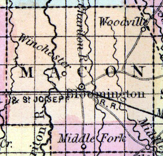
MACON COUNTY, situated in the northerly part of Missouri, and traversed by Chariton river. Area, 846 square miles. Seat of justice, Bloomington. Pop. in 1840, 6,034; in 1850, 6,565. (Fanning's, 1853)

MACON, a county towards the N. part of Missouri, has an area of 830 square miles. It is intersected by Chariton river, and by its East fork ; the E. part is drained by the South fork of Salt river, and the W. part by Wolf creek. The soil produces Indian corn, wheat, oats, hay, and tobacco. Cattle and swine are also among the staples. In 1850 the county yielded 420,023 bushels of corn ; 19,131 of wheat; 76,683 of oats; 9.54 tons of hay, and 845,110 pounds of tobacco. It contained 7 churches, 1 newspaper office, and 588 pupils attending public schools. Capital, Bloomington. Population, 6585, of whom 6262 were free, and 308, slaves. (Baldwin & Thomas, A New and Complete Gazetteer of the United States ...1854)


    Place Unit Type
    County
    Containing Unit
    Name Type
    Bloomington, MO City or Town
    How to Cite This Page: "Macon County, MO," House Divided: The Civil War Research Engine at Dickinson College, https://hd.housedivided.dickinson.edu/index.php/node/28309.