Pulaski County, MO

Headnote

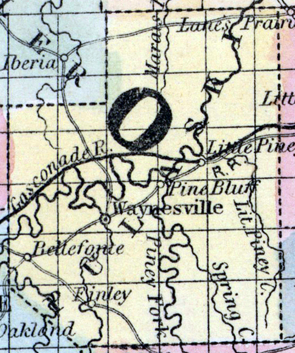
PULASKI COUNTY, situated toward the south part of Missouri. Area, 1,332 square miles. Seat of justice, Waynesville. Pop. in 1840, 6,529; in 1850, 3,998. (Fanning's, 1853)

PULASKI, a county in the S. central part of Missouri, has an area of about 1000 square miles. It is intersected by the Gasconade river flowing in a N. E. direction, and also drained in the S. part by the Ptobidoux and Big Piney fork, and Little Piney creek, which flow into the Gasconade. The surface is hilly ; the soil generally fertile. Indian corn, wheat, oats, grass, cattle, pork, and butter are the staples. In 1850 the county produced 246,430 bushels of corn; 11,352 of wheat; 32,838 of oats, and 54,827 pounds of butter. There were 75 pupils attending public schools. Limestone underlies a part of the land. The county is copiously supplied with water-power. Capital, Waynesville. Pop., 3998; of whom 3885 were free, and 113, slaves.  (Baldwin & Thomas, A New and Complete Gazetteer of the United States ... 1854)

    Place Unit Type
    County
    Containing Unit
    Name Type
    Waynesville, MO City or Town
    How to Cite This Page: "Pulaski County, MO," House Divided: The Civil War Research Engine at Dickinson College, https://hd.housedivided.dickinson.edu/index.php/node/28323.