

Scanned by
John Osborne
Scan date
Notes
Cropped, sized, and prepared for use by John Osborne, Dickinson College, November 12, 2009.
Image type
map
Original caption
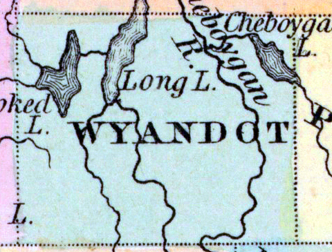
A New Map of Michigan with canals, roads, and distances
Source citation
Mitchell's New Universal Atlas.... (Philadelphia: Charles Desilver, 1857), 30.
Source note
Cropped from the larger original image of the state of Michigan, available as a zoomable image here.
Cheboygan County annexed Wyandot County in 1853. The 1857 Mitchell's Atlas maps do not yet reflect this.
Cheboygan County annexed Wyandot County in 1853. The 1857 Mitchell's Atlas maps do not yet reflect this.