

Scanned by
John Osborne, Dickinson College
Scan date
Notes
Some small staining due to use and age.
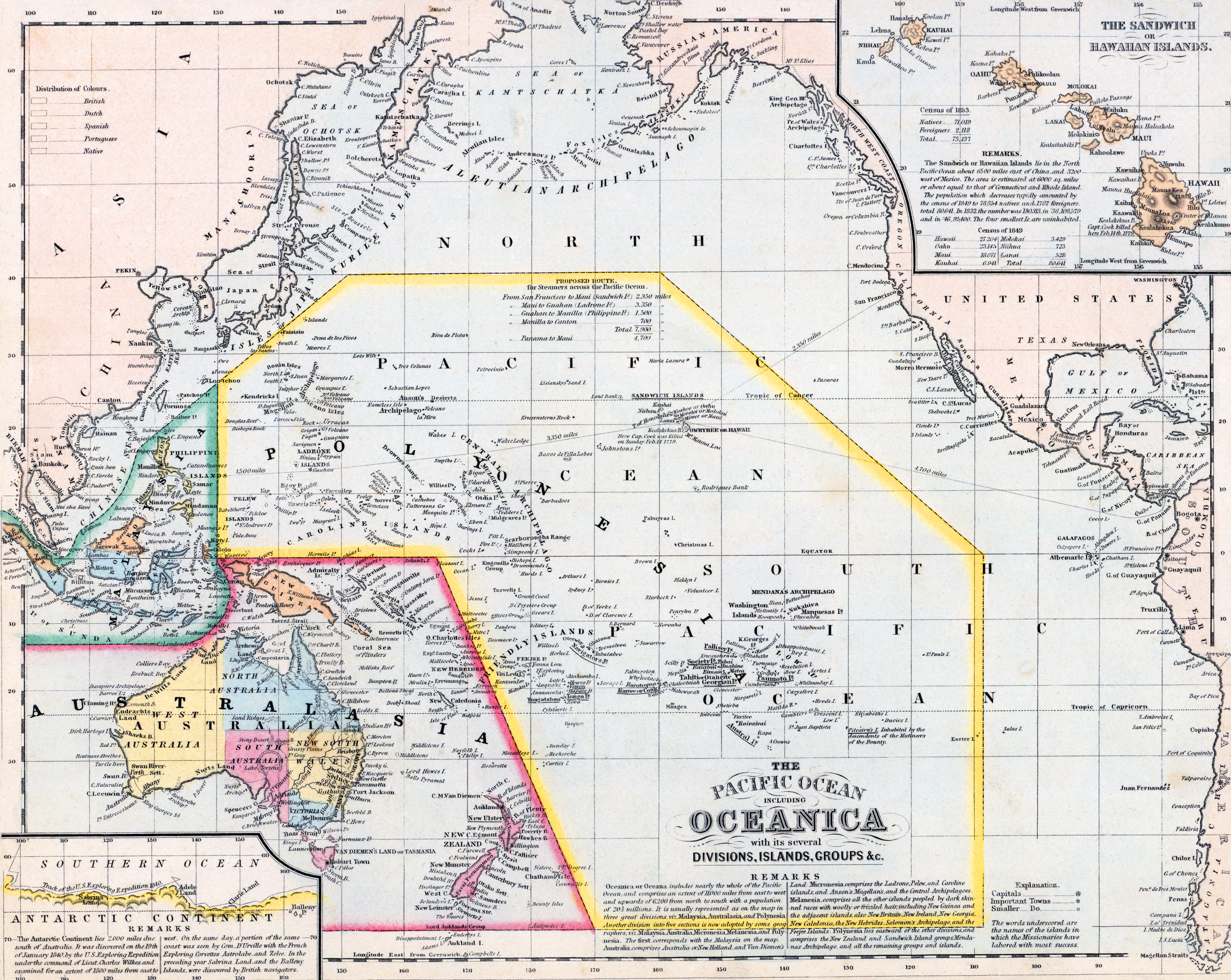
Depicted ContentPacific Ocean
Depicted ContentOceania
Depicted ContentNew Zealand
Depicted ContentAustralia
Depicted ContentPortuguese warship sinks in a storm on the Indian Ocean
Image type
map
Original caption
The Pacific Ocean including Oceanica with its several Divisions, Islands, Groups, etc.
Source citation
Mitchell's New Universal Atlas.... (Philadelphia: Charles Desilver, 1857), 76.