Scanned by
Internet Archive
Notes
Cropped, sized, and prepared for use here by John Osborne, March 2, 2012.
Image type
engraving
Original caption
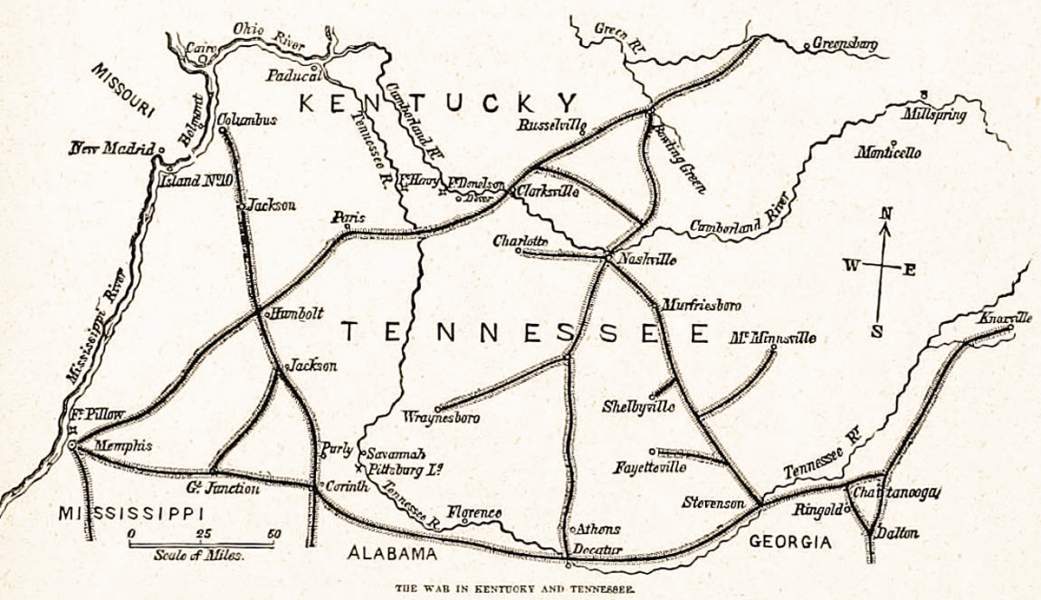
The War in Kentucky and Tennessee
Source citation
Alfred H. Guernsey and Henry M. Alden, Harper's Pictorial History of the Civil War (Chicago, IL: Puritan Press, 1894), I: 296.

