Search this site:
Documents
Images
People
Events
Places
Topics
Main Page
User's Guide
Site Navigation
About the Project
What is Anniversary Edition?
Credits
Dedication
Contact Us
Almanacs
1857
1858
1859
1860
1861
1862
1863
Teacher’s Guide
Project Index
Blog Divided
Journal Divided
L-D Debates Digital Classroom
Digital Lincoln
UGRR Digital Classroom
Video Channel
Texas Farmer's Civil War
Collections
People
Places
Events
Major Topics
Documents
Images
Bibliography
User login
Username:
*
Password:
*
Request new password
Syndicate
Home
›
Images
Harrisburg, Pennsylvania, 1855, zoomable cityscape map
View
Zoomify
Original
Thumbnail
Scanned by
Library of Congress
Notes
Cropped, sized, and prepared for use here by John Osborne, Dickinson College, May 29, 2008.
Depicted content
Harrisburg, PA
Image type
map
Courtesy of
Library of Congress Geography and Map Division
Original caption
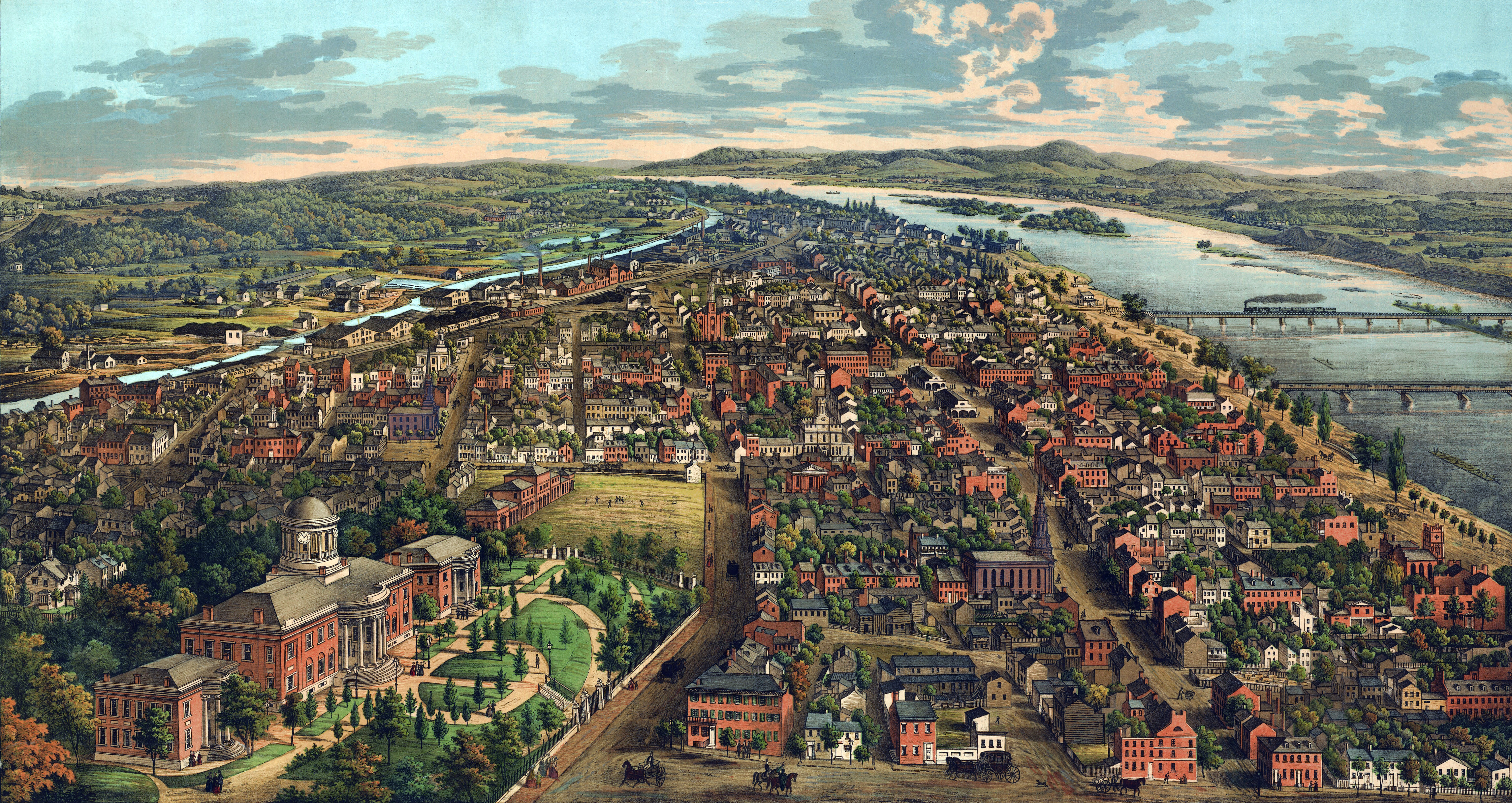
View of Harrisburg, Penn. Drawn on stone from nature & the daguerreotype by J.T. Williams. Lith. & printed in colors by E. Sachse & Co.
Source citation:
Panoramic Maps Collection, Library of Congress
Source note
Published York, PA, 1855
Login
to post comments
Original
Thumbnail
Wed, 01/28/2009 - 2:55pm — osborne