
Scanned by
Library of Congress
Notes
Cropped, sized, and prepared for use here by John Osborne, Dickinson College, August 11, 2009.
Image type
map
Courtesy of
Library of Congress Geography and Maps Division
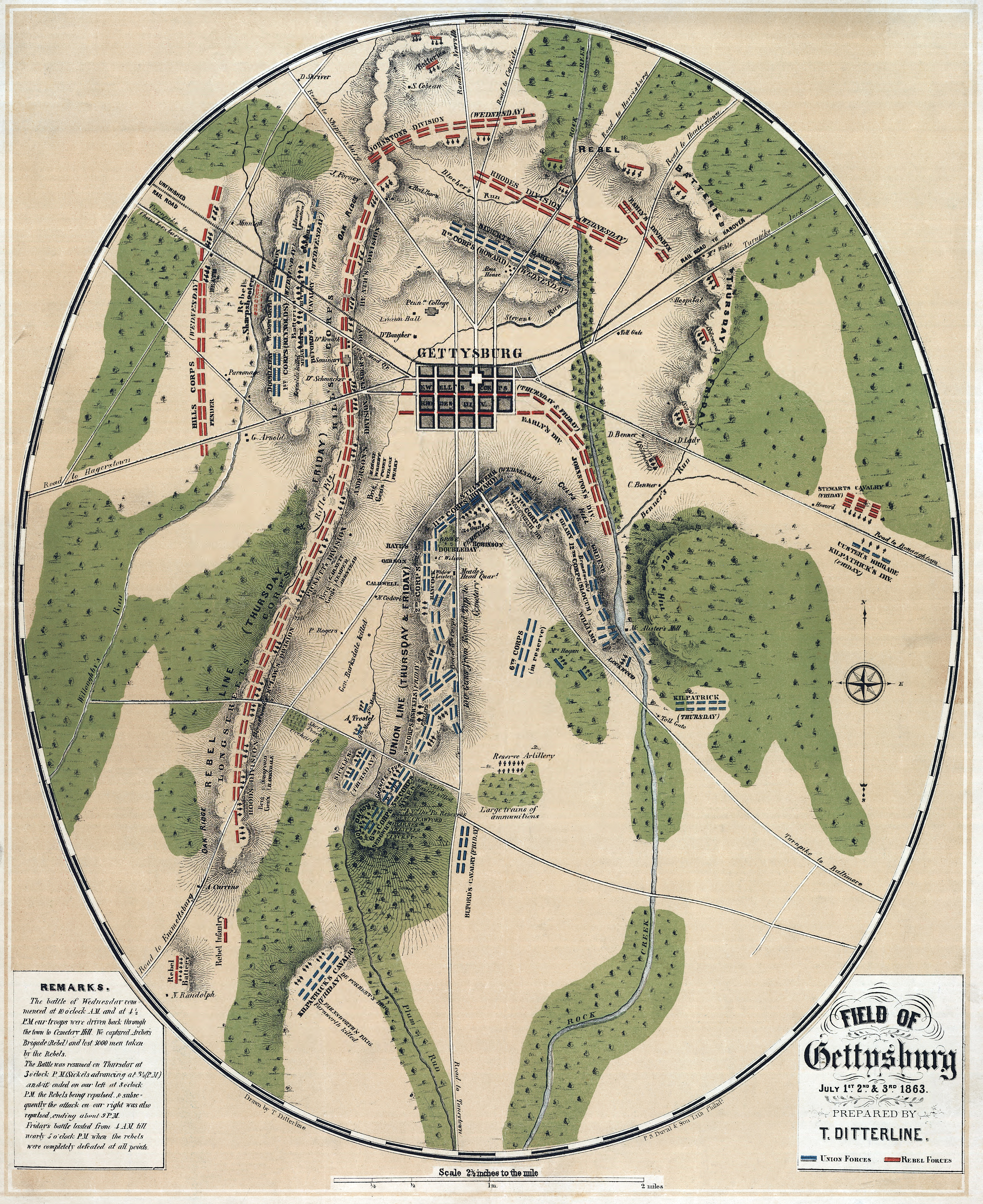
Original caption
Field of Gettysburg, July 1st, 2nd, 3rd, 1863 by T. Ditterline.
Source citation
Civil War Map Collection, Library of Congress Geography and Maps Division
Source note
Artist: Theodore Dittterline