
Download image

Scanned by
John Osborne, Dickinson College
Scan date
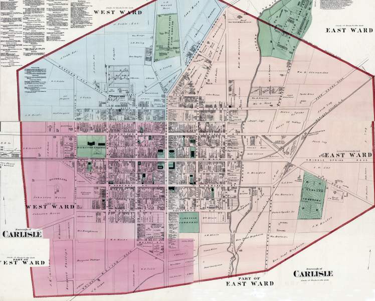
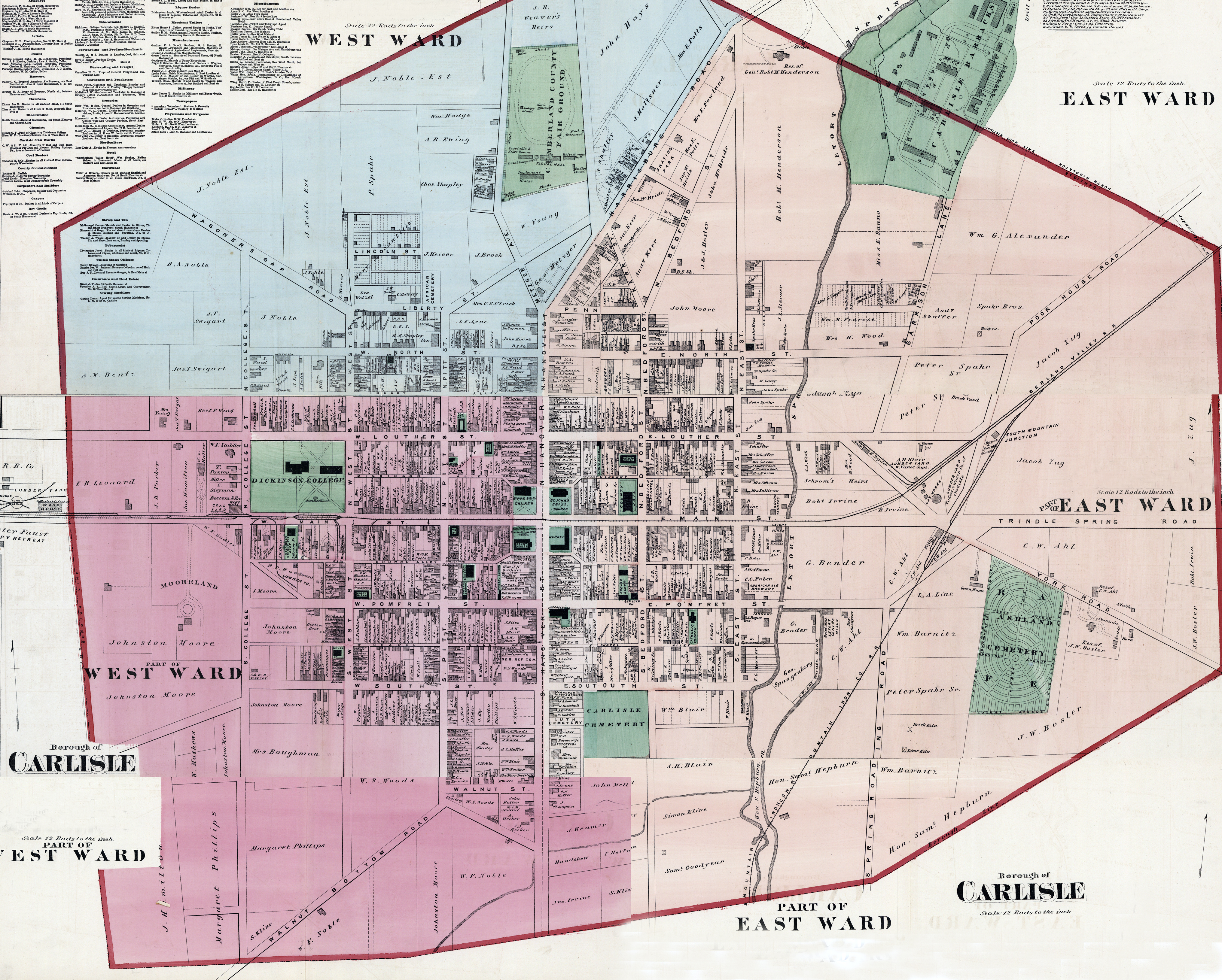
Depicted ContentCarlisle, PA
Image type
map
Courtesy of
Archives and Special Collections, Dickinson College, Carlisle, PA
Original caption
Borough of Carlisle
Source citation
Atlas of Cumberland Co. Pennsylvania. From actual surveys by and under the Direction of F.W. Beers (New York: F.W. Beers, Co., 1872), 39-41.
Source note
Lithographer: Charles Hart
Engraver: Louis E. Neuman
Engraver: Louis E. Neuman