Search this site:
Documents
Images
People
Events
Places
Topics
Main Page
User's Guide
Site Navigation
About the Project
What is Anniversary Edition?
Credits
Dedication
Contact Us
Almanacs
1857
1858
1859
1860
1861
1862
1863
Teacher’s Guide
Project Index
Blog Divided
Journal Divided
L-D Debates Digital Classroom
Digital Lincoln
UGRR Digital Classroom
Video Channel
Texas Farmer's Civil War
Collections
People
Places
Events
Major Topics
Documents
Images
Bibliography
User login
Username:
*
Password:
*
Request new password
Syndicate
Home
›
Images
Map of Burned Sections of Chambersburg, PA, 1864, zoomify
View
Zoomify
Original
Thumbnail
Scanned by
Don Sailer, Dickinson College
Notes
Cropped, edited, and prepared for use here by Don Sailer, Dickinson College, October 8, 2010.
Depicted content
Chambersburg, PA
Image type
map
Courtesy of
Dickinson College Archives and Special Collections
Original caption
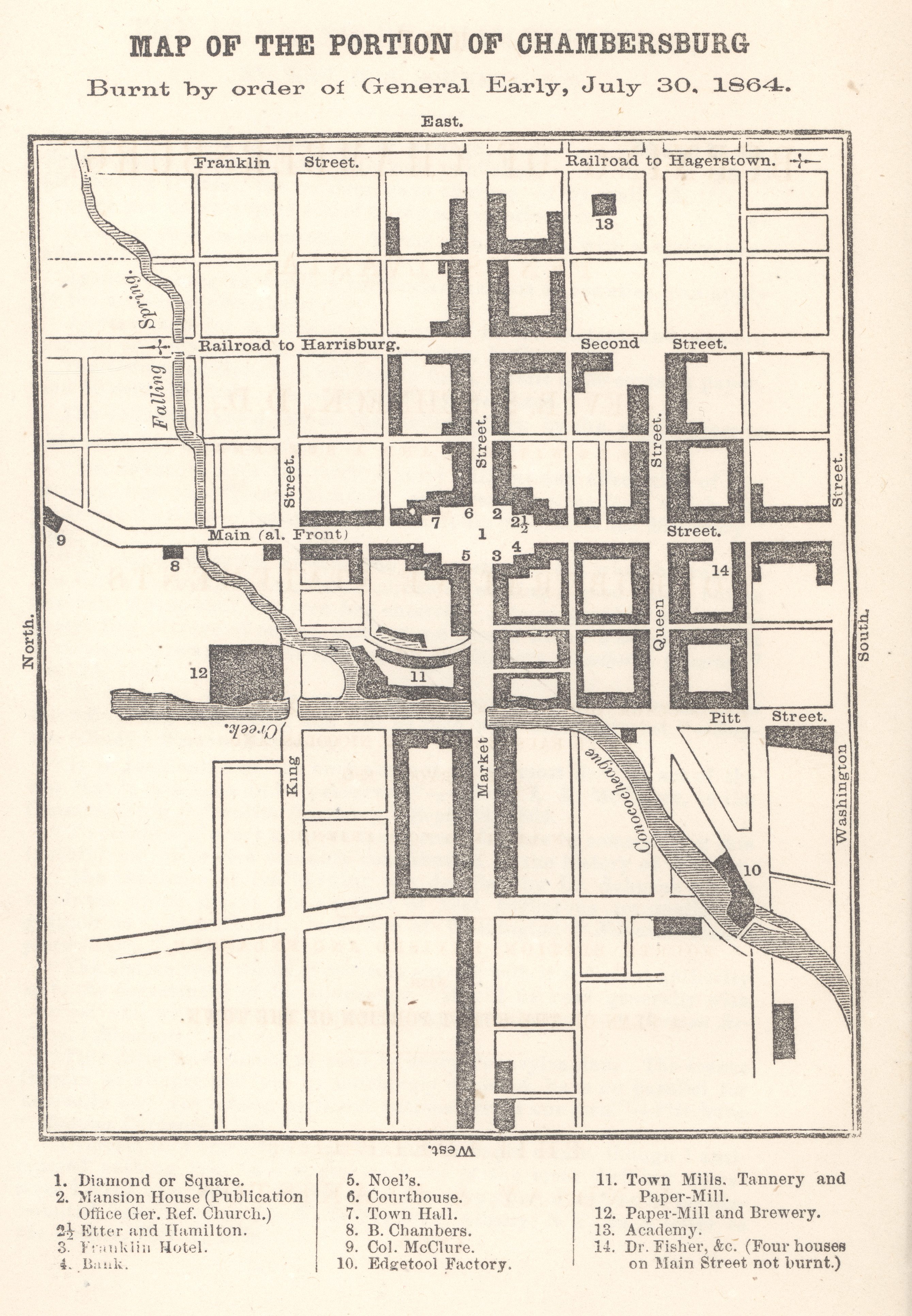
Map of the Portion of Chambersburg Burnt by order of General Early, July 30, 1864
Source citation:
B. Schneck,
The Burning of Chambersburg
(Philadelphia: Lindsay & Blakiston, 1864), frontispiece.
Source note
Original image has been adjusted here for presentation purposes.
Original
Thumbnail
Fri, 10/08/2010 - 2:56pm — sailerd