
Download image

Scanned by
John Osborne, Dickinson College
Scan date
Notes
Sized, cropped, and prepared for use here by John Osborne, Dickinson College, January 21, 2013
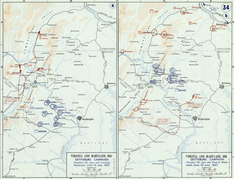
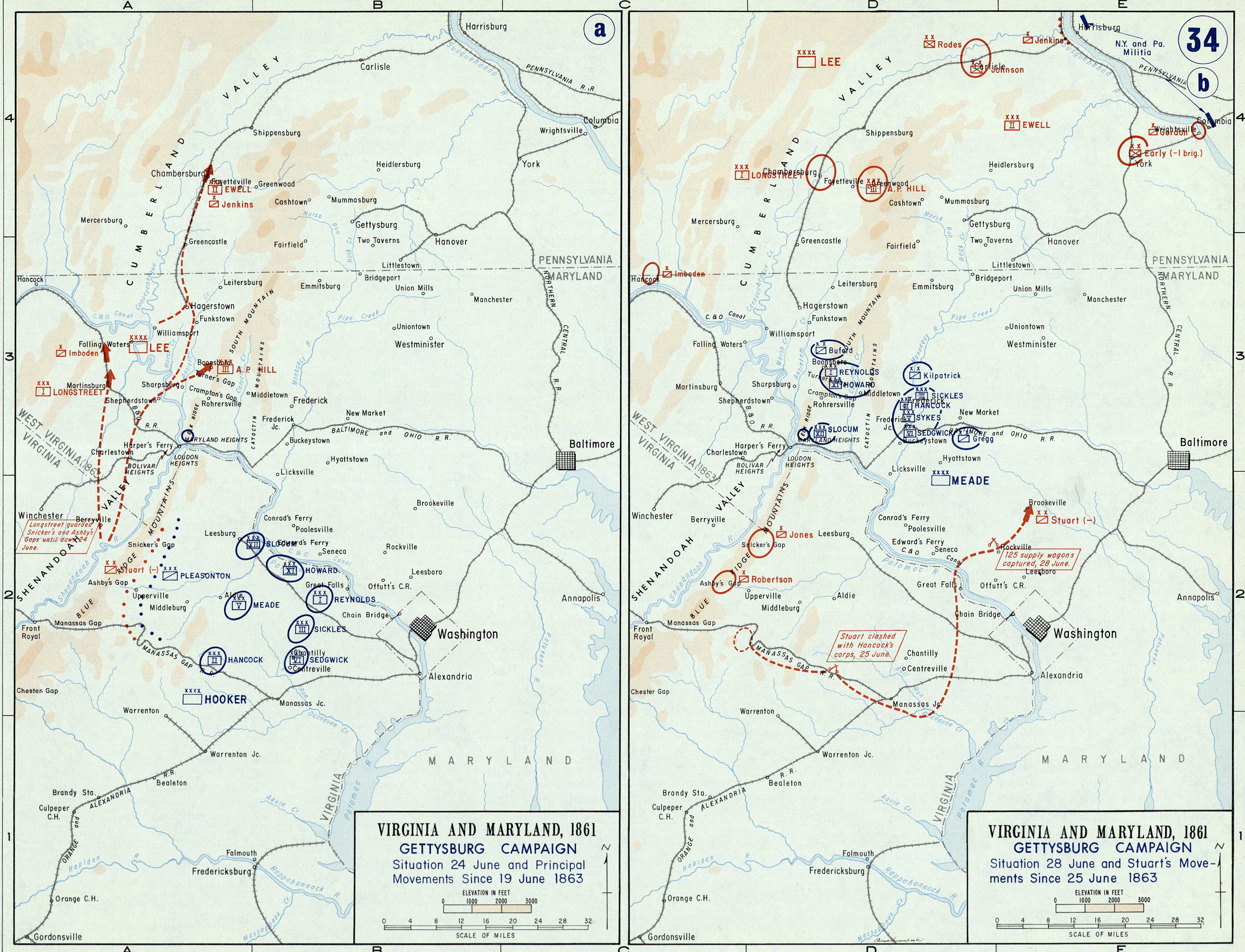
Depicted ContentGettysburg Campaign
Depicted ContentBattle of Gettysburg
Image type
map
Courtesy of
United States Military Academy
Original caption
Virginia and Maryland .. Gettysburg Campaign
Source citation
Gerald P. Stadler and Arthur V. Grant, Jr., Campaign Atlas of the American Civil War(West Point, NY: United States Military Academy, 1978), 34.
Source note
Cartographers: Edward J. Krasnoborski and George W. Giddings
For a table outlining campaign and battle symbols used on this map, see here. (Will open in a new window)