
Download image

Scanned by
John Osborne, Dickinson College
Scan date
Notes
Sized, cropped, and prepared for use here by John Osborne, Dickinson College, January 21, 2013
Image type
map
Courtesy of
United States Military Academy
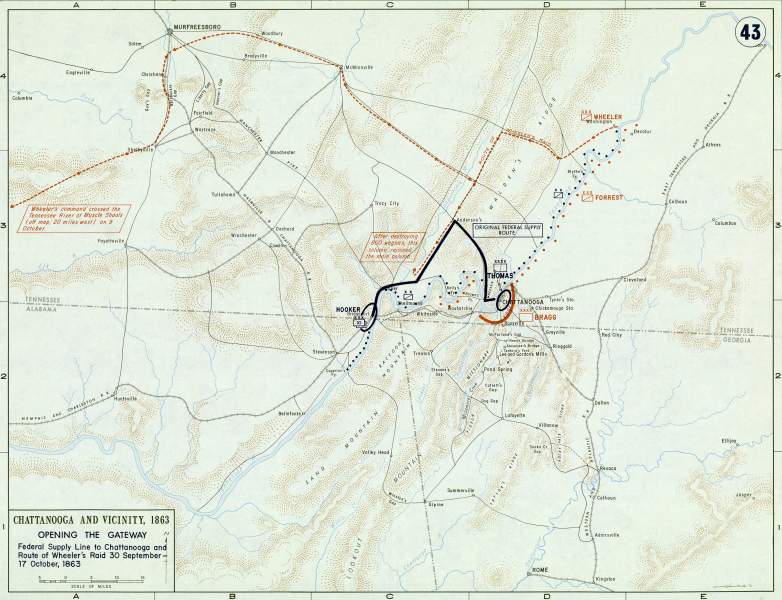
Original caption
Chattanooga and Vicinity, 1863 .. Opening the Gateway .. Federal Supply Line to Chattanooga and Route of Wheeler's Raid 30 Spetember to 17 October 1863
Source citation
Gerald P. Stadler and Arthur V. Grant, Jr., Campaign Atlas of the American Civil War(West Point, NY: United States Military Academy, 1978), 43.
Source note
Cartographers: Edward J. Krasnoborski and George W. Giddings
For a table outlining campaign and battle symbols used on this map, see here. (Will open in a new window)