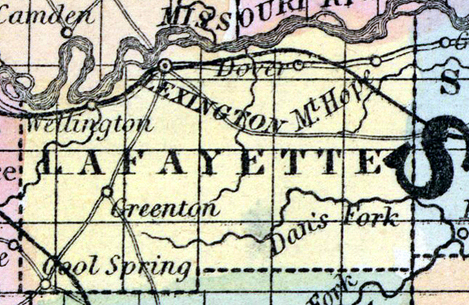
LAFAYETTE COUNTY, situated in the westerly part of Missouri, with Missouri river on the north. Area, 450 square miles. Seat of justice, Lexington. Pop. in 1840, 6,815; in 1850, 13,690. (Fanning's, 1853)
LAFAYETTE, (formerly Lillard,) a county in the W. part of Missouri, has an area of 612 square miles. The Missouri river, which here flows towards the E., forms the northern boundary; the county is also drained by Big Snybar and Terre Beau creeks, and by the Salt fork of Blackwater river. The surface is agreeably diversified; the soil is remarkably and almost uniformly fertile. The land is well watered, and about half of the county is heavily timbered. Indian corn, wheat, oats, hay, hemp, cattle, horses, and swine are the staples. In 1850 the county produced 788,675 bushels of corn; 83,037 of wheat ; 94,075 of oats ; 2462 tons of hemp ; 2358 tons of hay, and 154,663 pounds of butter. It contained 22 churches, 2 newspaper offices, 962 pupils attending public schools, and 513 attending academies and other schools. Limestone and sandstone underlie a large part of the county. The bluffs of the Missouri along the northern border consist almost entirely of beds of stone coal. Lafayette county is among the most populous and highly cultivated in the state. Capital, Lexington. Population, 13,690; of whom 9075 were free, and 4615, slaves.(Baldwin & Thomas, A New and Complete Gazetteer of the United States ... 1854)