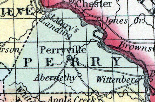
PERRY COUNTY, situated on the easterly boundary of Missouri, with Mississippi river on the northeast. Area, 400 square miles. Seat of justice, Perryville. Pop. in 1830, 3,349; in 1840, 5,760; in 1850, 2,438. (Fanning's, 1853)
PERRY, a county in the E. S. E. part of Missouri, has an area of 480 square miles. The Mississippi river, which separates it from Illinois, forms the boundary on the E. and N. E. ; it is also drained by Apple, Saline, and Cape Cinque Homme creeks. The surface is somewhat diversified; the soil is generally fertile, especially on the river bot-tom, which is about 3 miles wide. Indian corn, wheat, oats, butter, cattle, and swine are the staples. In 1850 the county produced 349,280 bushels of corn; 65,395 of wheat; 42,916 of oats, and 73,845 pounds of butter. It contained 14 churches, 360 pupils attending public schools, and 95 attending other schools. Lead and iron abound in the county; marble also is found in it, and blue limestone is the principal rock. The streams are said to furnish ample water-power. Capital, Perryville. Population, 7215, of whom 6421 were free, and 794, slaves. (Baldwin & Thomas, A New and Complete Gazetteer of the United States ... 1854)