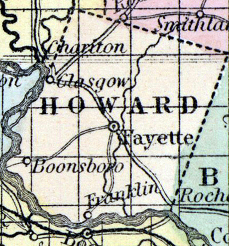
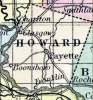
HOWARD COUNTY, situated toward the northern part of Missouri, with Missouri river on the south and west. Area, 398 square miles. Soil fertile. Seat of justice, Fayette. Pop. in 1830, 10,844; in 1840, 13,108; in 1850, 13,969. (Fanning's, 1853)
HOWARD, a county in the N. W. central part of Missouri, has an area of 432 square miles. The Missouri river forms part of its western, and the whole of its southern boundary. It is intersected by Bonne Femme and Moniteau creeks, affluents, of the Missouri river. The general surface is undulating; the soil is remarkably fertile, extensively cultivated, and supplied with abundant springs of limestone water. Indian corn, wheat, oats, tobacco, hay, hemp, cattle, and swine are the staples. In 1850 this county produced 939,048 bushels of corn; 114,196 of wheat; 97.534 of oats; 5401 tons of hay, and 3,188,122 pounds of tobacco. The above quantities of hay and tobacco were the greatest raised in any county of the state. It contained 19 churches, 2 newspaper offices, and 2053 pupils attending public schools. Valuable quarries of limestone and sandstone have been opened, and stone coal is abundant in the county. A plank-road is in progress of construction from Huntsville to Glasgow, the county seat. Named in honor of General Benjamin Howard, of Kentucky. Population, 13,969, of whom 9079 were free, and 4890, slaves. (Baldwin & Thomas, A New and Complete Gazetteer of the United States ... 1854)