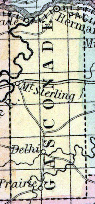
GASCONADE COUNTY, situated between the eastern and central parts of Missouri, on the southerly side of Missouri river, and traversed by Gasconade river. Area, 1,260 square miles. Face of the country uneven; soil, on the lowlands, fertile. Seat of justice, Hermann. Pop. in 1830, 1,545; in 1840, 5,330; in 1850, 4,996. (Fanning's, 1853)
GASCONADE, a county in the E. part of Missouri, has an area of 540 square miles. It is bounded on the N. by the Missouri river, and intersected in the N. W. part by the Gasconade river, from which the name is derived. The Bourbeuse creek and several of its branches flow through the S. E. part of the county. The surface is uneven and broken: the soil is inferior, excepting the river bottoms and lowlands. Indian corn, wheat, oats, cattle, pork, and butter are the staples. The manufacture of wine has lately commenced. In 1850, this county produced 190,913 bushels of corn; 20,427 of wheat, and 26,269 of oats. It contained 3 churches, 2 newspaper offices, 73 pupils attending public schools, and 72 attending academies or other schools. Iron ore and sulphur are abundant, and indications of copper along Bourbeuse creek are reported. Limestone underlies the greater part of the county, and burrstone of good quality is found on the Gasconade. Small steamboats navigate the river when the water is high. The county is well supplied with timber and water power. Capital, Hermann. Population, 4996, of whom 4884 were free, and 112, slaves. (Baldwin & Thomas, A New and Complete Gazetteer of the United States ... 1854)