Laclede County, MO

Headnote

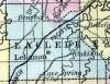
LACLEDE COUNTY, situated in the south part of Missouri. Area, --------- square miles. Seat of justice, Cave Spring. Pop. in 1850, 2,498. (Fanning's, 1853)

LA CLEDE, formerly Kinderhook, a county in the S. central part of Missouri, has an area of 750 square miles. It is intersected in the E. part by Gasconade river and its Osage fork, and also drained by the Niangua and Auglaize rivers. The surface is uneven, and consists partly of prairies and partly of forests of hard timber ; the soil produces Indian corn, wheat, oats, and pasture for cattle. In 1850 there were raised 136,829 bushels of corn; 9601 of wheat; 18,672 of oats, and 30,975 pounds of butter were made. La Clede was formed a few years ago out of the W. part of Pulaski county, and named in honor of La Clede, the founder of St. Louis. County seat not located. Population, 2498; of whom 2348 are free, and 140, slaves.  (Baldwin & Thomas, A New and Complete Gazetteer of the United States ... 1854)

    Place Unit Type
    County
    Containing Unit
    Name Type
    Lebanon, MO City or Town
    How to Cite This Page: "Laclede County, MO," House Divided: The Civil War Research Engine at Dickinson College, https://hd.housedivided.dickinson.edu/node/28407.