
Scanned by
Don Sailer, Dickinson College
Scan date
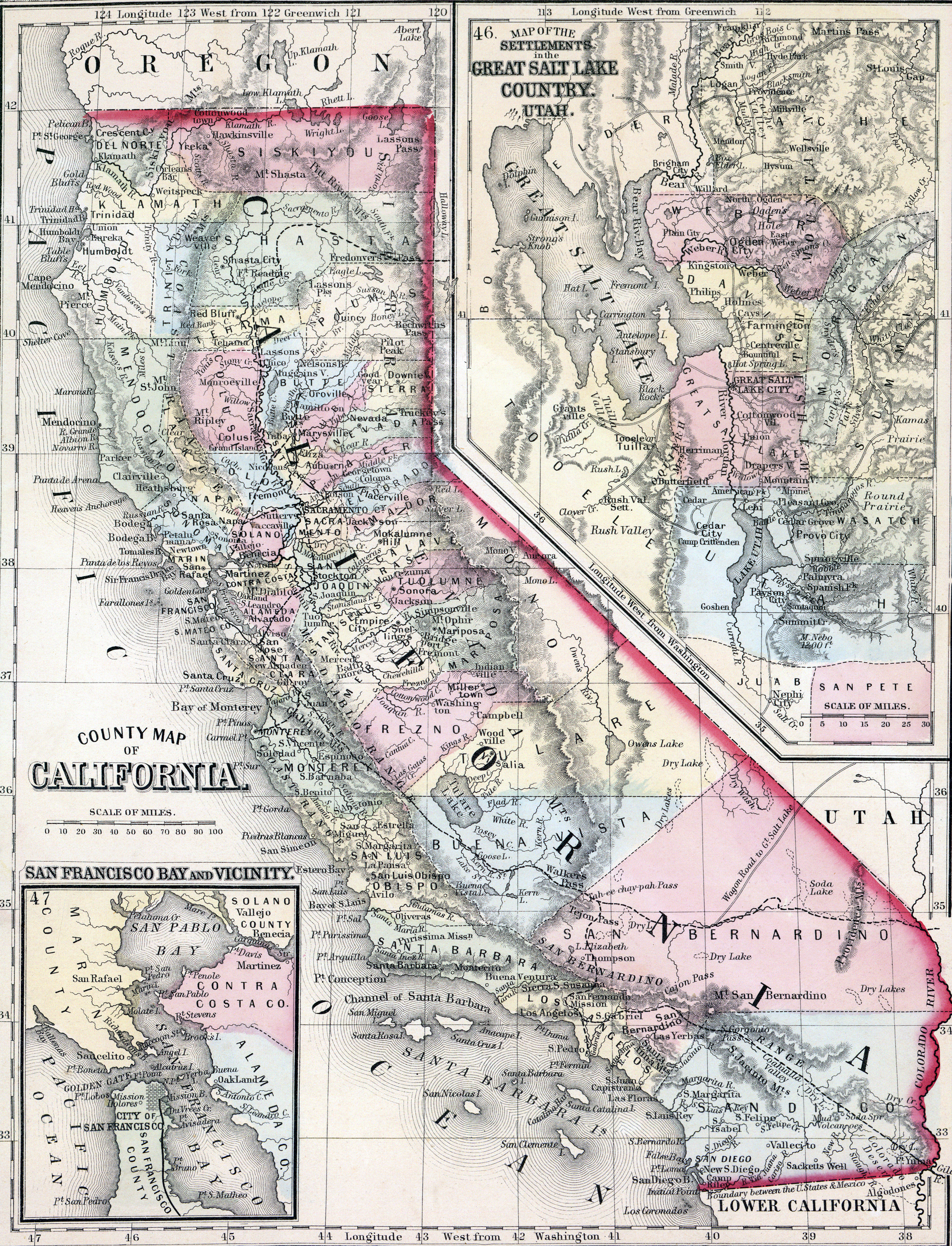
Image type
map
Original caption
County Map of California...Map of the Settlements of the Great Salt Lake Country, Utah
Source citation
Mitchell's New General Atlas.... (Philadelphia: S. Augustus Mitchell, 1866), 45.