
Scanned by
Don Sailer, Dickinson College
Scan date
Image type
map
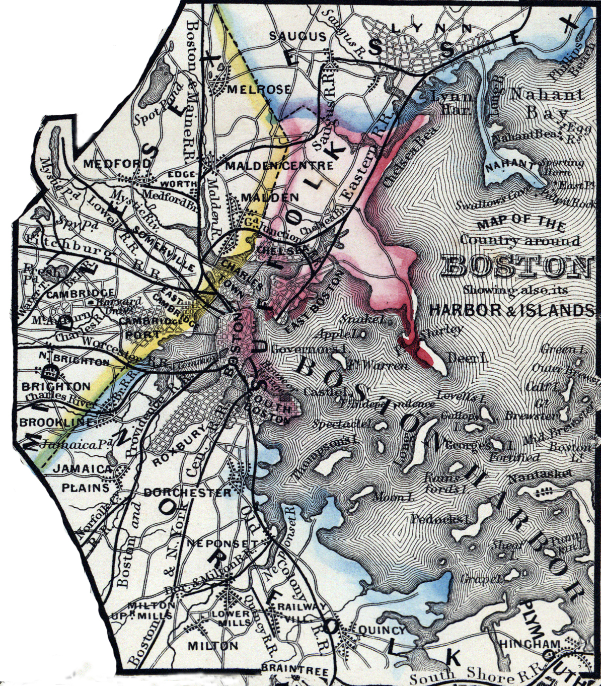
Original caption
Map of the Country around Boston showing its Harbor and Islands
Source citation
Mitchell's New General Atlas.... (Philadelphia: S. Augustus Mitchell, 1866), 20.
Source note
Cropped from a larger image, also available here.