
Scanned by
Rebecca Solnit, Dickinson College
Scan date
Notes
Sized, cropped, and adjusted for use here by John Osborne, Dickinson College, November 7, 2011.
Image type
map
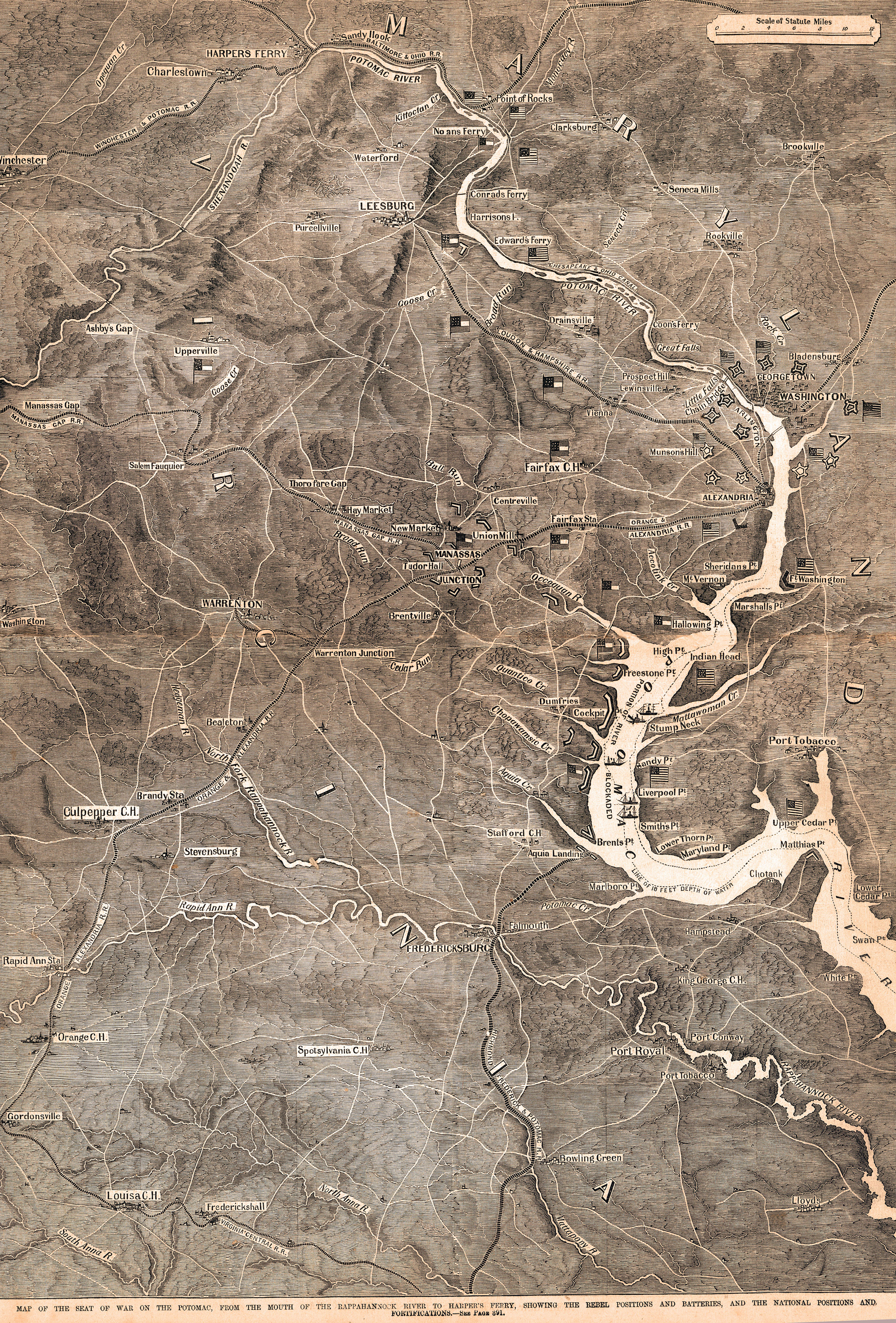
Original caption
Map of the seat of war on the Potomac, from the mouth of the Rappahannock River to Harpers Ferry, showing the Rebel positions and batteries, and the National positions and fortifications.
Source citation
Frank Leslie's Illustrated Newspaper, November 9, 1861, p. 392-393.