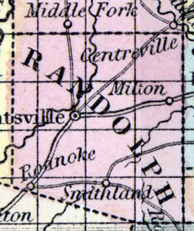
RANDOLPH COUNTY, situated toward the northeast part of Missouri. Area, 450 square miles. Seat of justice, Huntsville. Pop. in 1830, 2,942; in 1840, 7,198; in 1850, 9,439. (Fanning's, 1853)
RANDOLPH, a county in the N. central part of Missouri, has an area of 430 square miles. It is intersected by the East fork of Chariton river, and also drained by the Elk fork of Salt river, by the sources of Bonne Femme river, and by Silver creek. The surface is undulating, and diversified by prairies and forests ; the soil is remarkably fertile. Indian corn, wheat, oats, tobacco, butter, and pork are the staples. In 1850 the county produced 668,195 bushels of corn ; 35,483 of wheat; 109,830 of oats; 2,262,796 pounds of tobacco, and 138,768 of butter. It contained 14 churches, 607 pupils attending public schools, and 24 attending another school. Limestone is abundant, and coal is found. A plank-road extends from the Missouri to Huntsville, the capital. Pop. 9439, of whom 7283 were free, and 2156, slaves. (Baldwin & Thomas, A New and Complete Gazetteer of the United States ...1854)