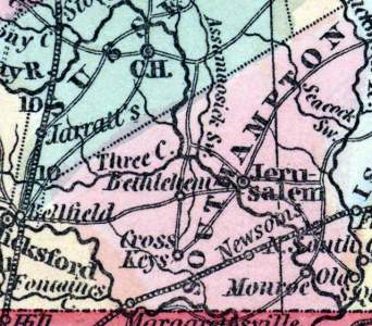
Southampton County, Virginia (Howe)
Gazetteer/Almanac
SOUTHAMPTON was formed in 1748, from Isle of Wight. Its length is 40, mean width 15 miles. The rail-road from Portsmouth to Welden, N. C., runs across the county. It is watered by the Meherrin, Nottoway, and Blackwater Rivers. The Nottoway is navigable for vessels of 70 tons, as far as Monroe, from which place produce and lumber are shipped to Norfolk. The Blackwater is navigable for large vessels to South Quay, in Nansemond. There were in 1840, whites 5,171, slaves 6,555, free colored 1,799; total. 14,525.
Henry Howe, Historical Collections of Virginia… (Charleston, SC: William R. Babcock, 1852), 470.


